You are here: Home > Network List > US - United States National Seismic Network Stations List
> Station MNTX Cornudas Mountains, Texas, USA > Earthquake Result Viewer
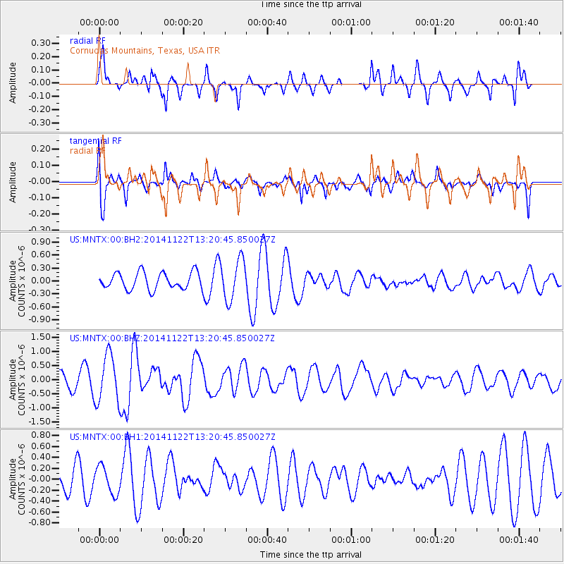
MNTX Cornudas Mountains, Texas, USA - Earthquake Result Viewer
*The percent match for this event was below the threshold and hence no stack was calculated.
| Earthquake location: |
Eastern Honshu, Japan |
| Earthquake latitude/longitude: |
36.6/137.9 |
| Earthquake time(UTC): |
2014/11/22 (326) 13:08:18 GMT |
| Earthquake Depth: |
10 km |
| Earthquake Magnitude: |
6.2 MWP |
| Earthquake Catalog/Contributor: |
NEIC PDE/NEIC COMCAT |
|
| Network: |
US United States National Seismic Network |
| Station: |
MNTX Cornudas Mountains, Texas, USA |
| Lat/Lon: |
31.70 N/105.38 W |
| Elevation: |
404 m |
|
| Distance: |
89.9 deg |
| Az: |
49.593 deg |
| Baz: |
314.069 deg |
| Ray Param: |
$rayparam |
*The percent match for this event was below the threshold and hence was not used in the summary stack. |
|
| Radial Match: |
60.89606 % |
| Radial Bump: |
311 |
| Transverse Match: |
63.75167 % |
| Transverse Bump: |
400 |
| SOD ConfigId: |
819644 |
| Insert Time: |
2014-12-06 13:48:32.123 +0000 |
| GWidth: |
2.5 |
| Max Bumps: |
400 |
| Tol: |
0.001 |
|
Signal To Noise
| Channel | StoN | STA | LTA |
| US:MNTX:00:BHZ:20141122T13:20:45.850027Z | 4.3799777 | 8.528942E-7 | 1.9472567E-7 |
| US:MNTX:00:BH1:20141122T13:20:45.850027Z | 1.6830975 | 2.602008E-7 | 1.5459639E-7 |
| US:MNTX:00:BH2:20141122T13:20:45.850027Z | 2.412354 | 4.7059612E-7 | 1.9507755E-7 |
| Arrivals |
| Ps | |
| PpPs | |
| PsPs/PpSs | |


