You are here: Home > Network List > TA - USArray Transportable Network (new EarthScope stations) Stations List
> Station 121A Cookes Peak, Deming, NM, USA > Earthquake Result Viewer
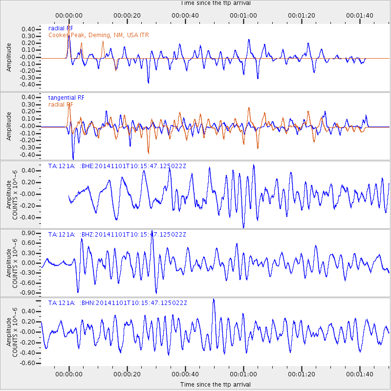
121A Cookes Peak, Deming, NM, USA - Earthquake Result Viewer
*The percent match for this event was below the threshold and hence no stack was calculated.
| Earthquake location: |
Easter Island Region |
| Earthquake latitude/longitude: |
-31.9/-111.1 |
| Earthquake time(UTC): |
2014/11/01 (305) 10:05:43 GMT |
| Earthquake Depth: |
10 km |
| Earthquake Magnitude: |
5.8 MWW, 5.6 MWB, 5.7 MWC |
| Earthquake Catalog/Contributor: |
NEIC PDE/NEIC COMCAT |
|
| Network: |
TA USArray Transportable Network (new EarthScope stations) |
| Station: |
121A Cookes Peak, Deming, NM, USA |
| Lat/Lon: |
32.53 N/107.79 W |
| Elevation: |
1652 m |
|
| Distance: |
64.2 deg |
| Az: |
3.117 deg |
| Baz: |
183.138 deg |
| Ray Param: |
$rayparam |
*The percent match for this event was below the threshold and hence was not used in the summary stack. |
|
| Radial Match: |
62.619907 % |
| Radial Bump: |
400 |
| Transverse Match: |
67.27611 % |
| Transverse Bump: |
359 |
| SOD ConfigId: |
820441 |
| Insert Time: |
2014-12-10 10:15:55.109 +0000 |
| GWidth: |
2.5 |
| Max Bumps: |
400 |
| Tol: |
0.001 |
|
Signal To Noise
| Channel | StoN | STA | LTA |
| TA:121A: :BHZ:20141101T10:15:47.125022Z | 3.8510714 | 3.9261218E-7 | 1.0194882E-7 |
| TA:121A: :BHN:20141101T10:15:47.125022Z | 0.64134943 | 1.312146E-7 | 2.0459144E-7 |
| TA:121A: :BHE:20141101T10:15:47.125022Z | 1.0812168 | 1.8114163E-7 | 1.6753498E-7 |
| Arrivals |
| Ps | |
| PpPs | |
| PsPs/PpSs | |


