You are here: Home > Network List > TA - USArray Transportable Network (new EarthScope stations) Stations List
> Station N23A Red Feather Lakes, CO, USA > Earthquake Result Viewer
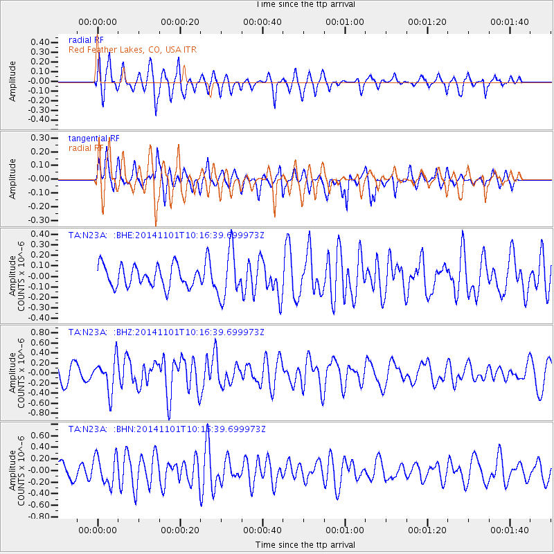
N23A Red Feather Lakes, CO, USA - Earthquake Result Viewer
*The percent match for this event was below the threshold and hence no stack was calculated.
| Earthquake location: |
Easter Island Region |
| Earthquake latitude/longitude: |
-31.9/-111.1 |
| Earthquake time(UTC): |
2014/11/01 (305) 10:05:43 GMT |
| Earthquake Depth: |
10 km |
| Earthquake Magnitude: |
5.8 MWW, 5.6 MWB, 5.7 MWC |
| Earthquake Catalog/Contributor: |
NEIC PDE/NEIC COMCAT |
|
| Network: |
TA USArray Transportable Network (new EarthScope stations) |
| Station: |
N23A Red Feather Lakes, CO, USA |
| Lat/Lon: |
40.89 N/105.94 W |
| Elevation: |
2458 m |
|
| Distance: |
72.6 deg |
| Az: |
4.099 deg |
| Baz: |
184.6 deg |
| Ray Param: |
$rayparam |
*The percent match for this event was below the threshold and hence was not used in the summary stack. |
|
| Radial Match: |
63.001587 % |
| Radial Bump: |
400 |
| Transverse Match: |
56.193546 % |
| Transverse Bump: |
400 |
| SOD ConfigId: |
820441 |
| Insert Time: |
2014-12-10 10:18:47.386 +0000 |
| GWidth: |
2.5 |
| Max Bumps: |
400 |
| Tol: |
0.001 |
|
Signal To Noise
| Channel | StoN | STA | LTA |
| TA:N23A: :BHZ:20141101T10:16:39.699973Z | 1.6718186 | 3.3282106E-7 | 1.9907725E-7 |
| TA:N23A: :BHN:20141101T10:16:39.699973Z | 1.8185995 | 2.5587082E-7 | 1.4069663E-7 |
| TA:N23A: :BHE:20141101T10:16:39.699973Z | 2.339192 | 2.3057373E-7 | 9.856982E-8 |
| Arrivals |
| Ps | |
| PpPs | |
| PsPs/PpSs | |


