You are here: Home > Network List > TA - USArray Transportable Network (new EarthScope stations) Stations List
> Station Q53A Leroy, WV, USA > Earthquake Result Viewer
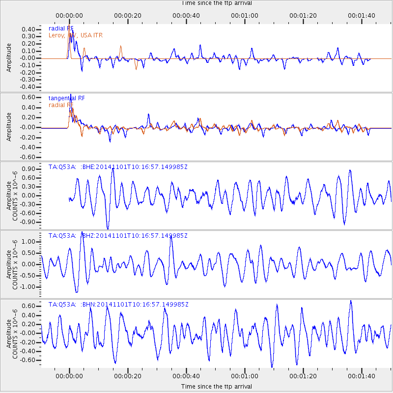
Q53A Leroy, WV, USA - Earthquake Result Viewer
*The percent match for this event was below the threshold and hence no stack was calculated.
| Earthquake location: |
Easter Island Region |
| Earthquake latitude/longitude: |
-31.9/-111.1 |
| Earthquake time(UTC): |
2014/11/01 (305) 10:05:43 GMT |
| Earthquake Depth: |
10 km |
| Earthquake Magnitude: |
5.8 MWW, 5.6 MWB, 5.7 MWC |
| Earthquake Catalog/Contributor: |
NEIC PDE/NEIC COMCAT |
|
| Network: |
TA USArray Transportable Network (new EarthScope stations) |
| Station: |
Q53A Leroy, WV, USA |
| Lat/Lon: |
38.86 N/81.53 W |
| Elevation: |
310 m |
|
| Distance: |
75.6 deg |
| Az: |
23.448 deg |
| Baz: |
205.684 deg |
| Ray Param: |
$rayparam |
*The percent match for this event was below the threshold and hence was not used in the summary stack. |
|
| Radial Match: |
63.742676 % |
| Radial Bump: |
400 |
| Transverse Match: |
65.54585 % |
| Transverse Bump: |
397 |
| SOD ConfigId: |
820441 |
| Insert Time: |
2014-12-10 10:19:37.841 +0000 |
| GWidth: |
2.5 |
| Max Bumps: |
400 |
| Tol: |
0.001 |
|
Signal To Noise
| Channel | StoN | STA | LTA |
| TA:Q53A: :BHZ:20141101T10:16:57.149985Z | 2.4027076 | 8.52319E-7 | 3.5473272E-7 |
| TA:Q53A: :BHN:20141101T10:16:57.149985Z | 0.86830366 | 1.9011104E-7 | 2.1894533E-7 |
| TA:Q53A: :BHE:20141101T10:16:57.149985Z | 0.6162927 | 2.5677028E-7 | 4.1663688E-7 |
| Arrivals |
| Ps | |
| PpPs | |
| PsPs/PpSs | |


