You are here: Home > Network List > TA - USArray Transportable Network (new EarthScope stations) Stations List
> Station Z41A Richland Creek Farm, El Dorado, AR, USA > Earthquake Result Viewer
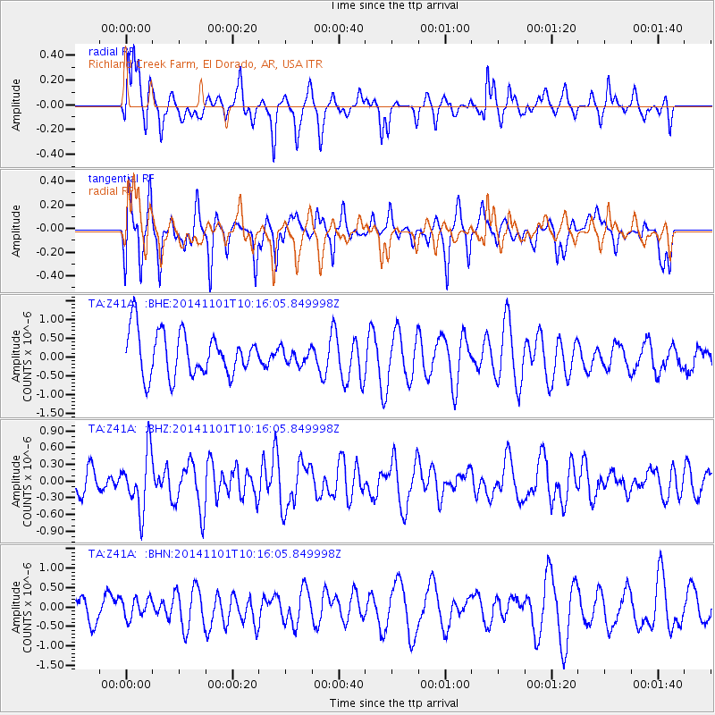
Z41A Richland Creek Farm, El Dorado, AR, USA - Earthquake Result Viewer
*The percent match for this event was below the threshold and hence no stack was calculated.
| Earthquake location: |
Easter Island Region |
| Earthquake latitude/longitude: |
-31.9/-111.1 |
| Earthquake time(UTC): |
2014/11/01 (305) 10:05:43 GMT |
| Earthquake Depth: |
10 km |
| Earthquake Magnitude: |
5.8 MWW, 5.6 MWB, 5.7 MWC |
| Earthquake Catalog/Contributor: |
NEIC PDE/NEIC COMCAT |
|
| Network: |
TA USArray Transportable Network (new EarthScope stations) |
| Station: |
Z41A Richland Creek Farm, El Dorado, AR, USA |
| Lat/Lon: |
33.26 N/92.80 W |
| Elevation: |
62 m |
|
| Distance: |
67.1 deg |
| Az: |
16.6 deg |
| Baz: |
196.854 deg |
| Ray Param: |
$rayparam |
*The percent match for this event was below the threshold and hence was not used in the summary stack. |
|
| Radial Match: |
55.218494 % |
| Radial Bump: |
362 |
| Transverse Match: |
44.677776 % |
| Transverse Bump: |
361 |
| SOD ConfigId: |
820441 |
| Insert Time: |
2014-12-10 10:21:45.490 +0000 |
| GWidth: |
2.5 |
| Max Bumps: |
400 |
| Tol: |
0.001 |
|
Signal To Noise
| Channel | StoN | STA | LTA |
| TA:Z41A: :BHZ:20141101T10:16:05.849998Z | 2.2000642 | 5.1487865E-7 | 2.3402892E-7 |
| TA:Z41A: :BHN:20141101T10:16:05.849998Z | 0.5832118 | 2.549834E-7 | 4.3720553E-7 |
| TA:Z41A: :BHE:20141101T10:16:05.849998Z | 0.36337894 | 2.118223E-7 | 5.829239E-7 |
| Arrivals |
| Ps | |
| PpPs | |
| PsPs/PpSs | |


