You are here: Home > Network List > US - United States National Seismic Network Stations List
> Station CBKS Cedar Bluff, Kansas, USA > Earthquake Result Viewer
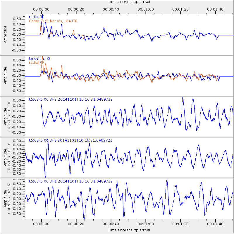
CBKS Cedar Bluff, Kansas, USA - Earthquake Result Viewer
*The percent match for this event was below the threshold and hence no stack was calculated.
| Earthquake location: |
Easter Island Region |
| Earthquake latitude/longitude: |
-31.9/-111.1 |
| Earthquake time(UTC): |
2014/11/01 (305) 10:05:43 GMT |
| Earthquake Depth: |
10 km |
| Earthquake Magnitude: |
5.8 MWW, 5.6 MWB, 5.7 MWC |
| Earthquake Catalog/Contributor: |
NEIC PDE/NEIC COMCAT |
|
| Network: |
US United States National Seismic Network |
| Station: |
CBKS Cedar Bluff, Kansas, USA |
| Lat/Lon: |
38.81 N/99.74 W |
| Elevation: |
677 m |
|
| Distance: |
71.2 deg |
| Az: |
9.365 deg |
| Baz: |
190.202 deg |
| Ray Param: |
$rayparam |
*The percent match for this event was below the threshold and hence was not used in the summary stack. |
|
| Radial Match: |
71.39488 % |
| Radial Bump: |
400 |
| Transverse Match: |
43.970486 % |
| Transverse Bump: |
400 |
| SOD ConfigId: |
820441 |
| Insert Time: |
2014-12-10 10:22:28.431 +0000 |
| GWidth: |
2.5 |
| Max Bumps: |
400 |
| Tol: |
0.001 |
|
Signal To Noise
| Channel | StoN | STA | LTA |
| US:CBKS:00:BHZ:20141101T10:16:31.048972Z | 3.5209236 | 4.6502407E-7 | 1.3207446E-7 |
| US:CBKS:00:BH1:20141101T10:16:31.048972Z | 1.7964941 | 3.3128578E-7 | 1.8440683E-7 |
| US:CBKS:00:BH2:20141101T10:16:31.048972Z | 1.3134217 | 2.1606526E-7 | 1.6450562E-7 |
| Arrivals |
| Ps | |
| PpPs | |
| PsPs/PpSs | |


