You are here: Home > Network List > TA - USArray Transportable Network (new EarthScope stations) Stations List
> Station M63A Gales Ferry, CT, USA > Earthquake Result Viewer
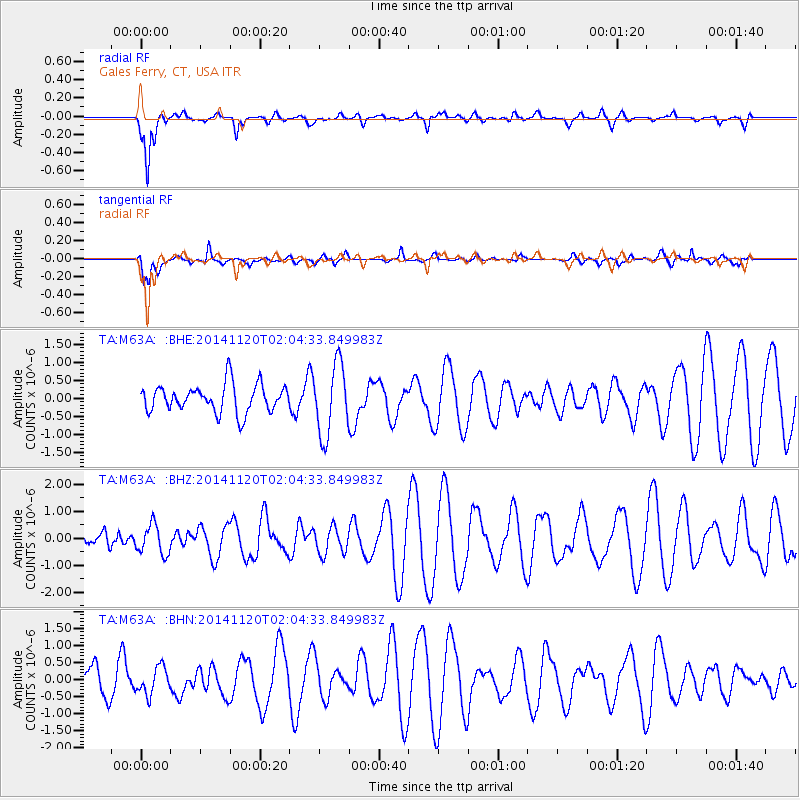
M63A Gales Ferry, CT, USA - Earthquake Result Viewer
*The percent match for this event was below the threshold and hence no stack was calculated.
| Earthquake location: |
Near East Coast Of Honshu, Japan |
| Earthquake latitude/longitude: |
37.3/141.6 |
| Earthquake time(UTC): |
2014/11/20 (324) 01:51:42 GMT |
| Earthquake Depth: |
32 km |
| Earthquake Magnitude: |
5.6 MWW, 5.5 MWB, 5.5 MWR, 5.6 MWC |
| Earthquake Catalog/Contributor: |
NEIC PDE/NEIC COMCAT |
|
| Network: |
TA USArray Transportable Network (new EarthScope stations) |
| Station: |
M63A Gales Ferry, CT, USA |
| Lat/Lon: |
41.40 N/72.05 W |
| Elevation: |
44 m |
|
| Distance: |
95.8 deg |
| Az: |
24.774 deg |
| Baz: |
333.636 deg |
| Ray Param: |
$rayparam |
*The percent match for this event was below the threshold and hence was not used in the summary stack. |
|
| Radial Match: |
76.6746 % |
| Radial Bump: |
400 |
| Transverse Match: |
59.290115 % |
| Transverse Bump: |
400 |
| SOD ConfigId: |
821188 |
| Insert Time: |
2014-12-15 05:39:13.057 +0000 |
| GWidth: |
2.5 |
| Max Bumps: |
400 |
| Tol: |
0.001 |
|
Signal To Noise
| Channel | StoN | STA | LTA |
| TA:M63A: :BHZ:20141120T02:04:33.849983Z | 0.3449683 | 5.511009E-7 | 1.5975407E-6 |
| TA:M63A: :BHN:20141120T02:04:33.849983Z | 0.3678186 | 3.961327E-7 | 1.0769785E-6 |
| TA:M63A: :BHE:20141120T02:04:33.849983Z | 2.558532 | 9.866077E-7 | 3.8561475E-7 |
| Arrivals |
| Ps | |
| PpPs | |
| PsPs/PpSs | |


