You are here: Home > Network List > TA - USArray Transportable Network (new EarthScope stations) Stations List
> Station O03E Paynes Creek, CA, USA > Earthquake Result Viewer
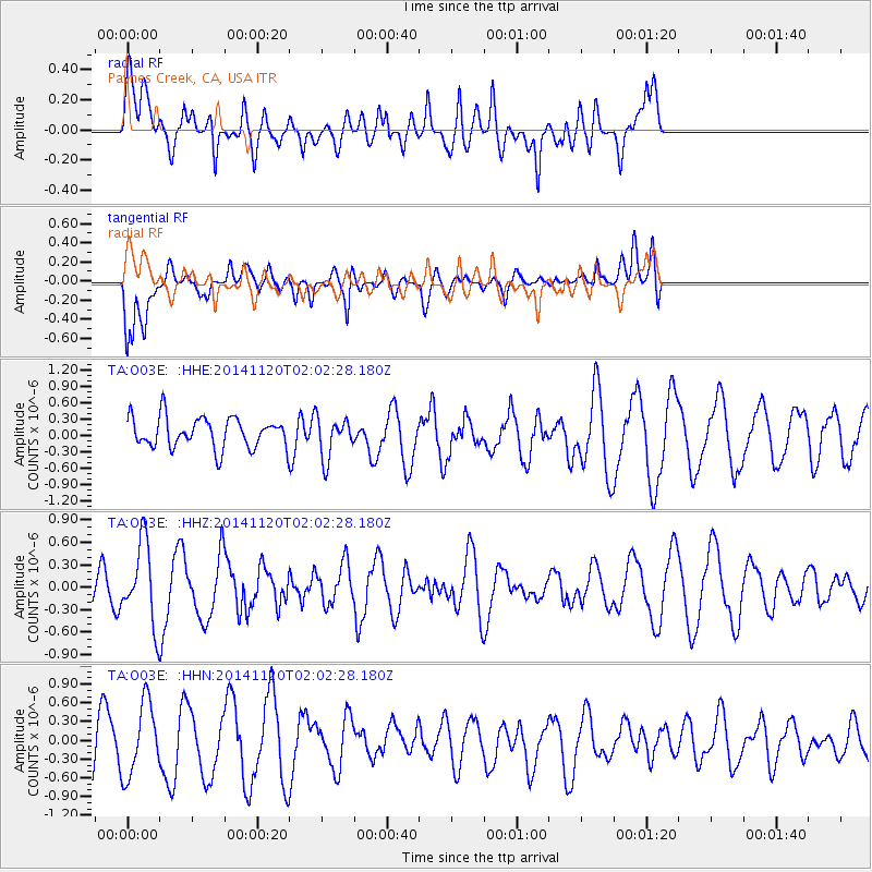
O03E Paynes Creek, CA, USA - Earthquake Result Viewer
*The percent match for this event was below the threshold and hence no stack was calculated.
| Earthquake location: |
Near East Coast Of Honshu, Japan |
| Earthquake latitude/longitude: |
37.3/141.6 |
| Earthquake time(UTC): |
2014/11/20 (324) 01:51:42 GMT |
| Earthquake Depth: |
32 km |
| Earthquake Magnitude: |
5.6 MWW, 5.5 MWB, 5.5 MWR, 5.6 MWC |
| Earthquake Catalog/Contributor: |
NEIC PDE/NEIC COMCAT |
|
| Network: |
TA USArray Transportable Network (new EarthScope stations) |
| Station: |
O03E Paynes Creek, CA, USA |
| Lat/Lon: |
40.29 N/121.80 W |
| Elevation: |
967 m |
|
| Distance: |
71.4 deg |
| Az: |
53.29 deg |
| Baz: |
303.326 deg |
| Ray Param: |
$rayparam |
*The percent match for this event was below the threshold and hence was not used in the summary stack. |
|
| Radial Match: |
49.563564 % |
| Radial Bump: |
400 |
| Transverse Match: |
39.475346 % |
| Transverse Bump: |
400 |
| SOD ConfigId: |
821188 |
| Insert Time: |
2014-12-15 05:39:31.020 +0000 |
| GWidth: |
2.5 |
| Max Bumps: |
400 |
| Tol: |
0.001 |
|
Signal To Noise
| Channel | StoN | STA | LTA |
| TA:O03E: :HHZ:20141120T02:02:28.180Z | 1.7839751 | 5.329005E-7 | 2.9871524E-7 |
| TA:O03E: :HHN:20141120T02:02:28.180Z | 1.560285 | 5.840186E-7 | 3.7430252E-7 |
| TA:O03E: :HHE:20141120T02:02:28.180Z | 1.3680872 | 3.7484344E-7 | 2.739909E-7 |
| Arrivals |
| Ps | |
| PpPs | |
| PsPs/PpSs | |


