You are here: Home > Network List > TA - USArray Transportable Network (new EarthScope stations) Stations List
> Station I23K Minto, Yukon-Koyukuk, AK, USA > Earthquake Result Viewer
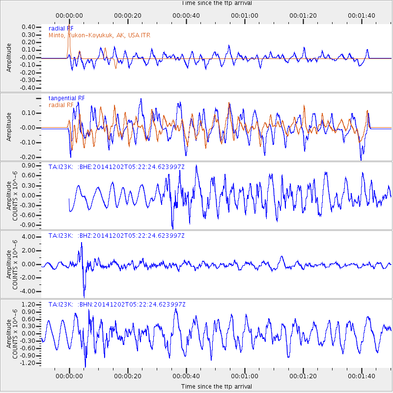
I23K Minto, Yukon-Koyukuk, AK, USA - Earthquake Result Viewer
*The percent match for this event was below the threshold and hence no stack was calculated.
| Earthquake location: |
Mindanao, Philippines |
| Earthquake latitude/longitude: |
6.1/123.1 |
| Earthquake time(UTC): |
2014/12/02 (336) 05:11:31 GMT |
| Earthquake Depth: |
614 km |
| Earthquake Magnitude: |
6.6 MWW, 6.6 MWC, 6.6 MWB |
| Earthquake Catalog/Contributor: |
NEIC PDE/NEIC COMCAT |
|
| Network: |
TA USArray Transportable Network (new EarthScope stations) |
| Station: |
I23K Minto, Yukon-Koyukuk, AK, USA |
| Lat/Lon: |
65.15 N/149.36 W |
| Elevation: |
149 m |
|
| Distance: |
83.5 deg |
| Az: |
25.149 deg |
| Baz: |
270.316 deg |
| Ray Param: |
$rayparam |
*The percent match for this event was below the threshold and hence was not used in the summary stack. |
|
| Radial Match: |
58.354843 % |
| Radial Bump: |
400 |
| Transverse Match: |
62.31341 % |
| Transverse Bump: |
400 |
| SOD ConfigId: |
821389 |
| Insert Time: |
2014-12-16 05:36:48.533 +0000 |
| GWidth: |
2.5 |
| Max Bumps: |
400 |
| Tol: |
0.001 |
|
Signal To Noise
| Channel | StoN | STA | LTA |
| TA:I23K: :BHZ:20141202T05:22:24.623997Z | 4.963233 | 1.1363305E-6 | 2.2894967E-7 |
| TA:I23K: :BHN:20141202T05:22:24.623997Z | 2.0931077 | 4.654048E-7 | 2.2235109E-7 |
| TA:I23K: :BHE:20141202T05:22:24.623997Z | 1.3115277 | 3.050026E-7 | 2.3255521E-7 |
| Arrivals |
| Ps | |
| PpPs | |
| PsPs/PpSs | |


