You are here: Home > Network List > GS - US Geological Survey Networks Stations List
> Station DEC07 Decatur Surface Seismic Site, Decatur, IL, USA > Earthquake Result Viewer
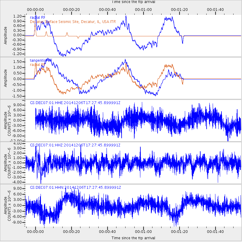
DEC07 Decatur Surface Seismic Site, Decatur, IL, USA - Earthquake Result Viewer
*The percent match for this event was below the threshold and hence no stack was calculated.
| Earthquake location: |
South Of Panama |
| Earthquake latitude/longitude: |
8.0/-82.7 |
| Earthquake time(UTC): |
2014/12/06 (340) 17:21:48 GMT |
| Earthquake Depth: |
14 km |
| Earthquake Magnitude: |
6.0 MWW, 5.8 MWB, 6.0 MWC |
| Earthquake Catalog/Contributor: |
NEIC PDE/NEIC COMCAT |
|
| Network: |
GS US Geological Survey Networks |
| Station: |
DEC07 Decatur Surface Seismic Site, Decatur, IL, USA |
| Lat/Lon: |
39.86 N/88.90 W |
| Elevation: |
212 m |
|
| Distance: |
32.2 deg |
| Az: |
351.056 deg |
| Baz: |
168.459 deg |
| Ray Param: |
$rayparam |
*The percent match for this event was below the threshold and hence was not used in the summary stack. |
|
| Radial Match: |
59.3323 % |
| Radial Bump: |
400 |
| Transverse Match: |
70.93247 % |
| Transverse Bump: |
400 |
| SOD ConfigId: |
821842 |
| Insert Time: |
2014-12-20 17:39:25.229 +0000 |
| GWidth: |
2.5 |
| Max Bumps: |
400 |
| Tol: |
0.001 |
|
Signal To Noise
| Channel | StoN | STA | LTA |
| GS:DEC07:01:HHZ:20141206T17:27:45.899991Z | 1.8008677 | 1.6559919E-6 | 9.1955224E-7 |
| GS:DEC07:01:HHN:20141206T17:27:45.899991Z | 1.5060996 | 4.9128303E-6 | 3.2619557E-6 |
| GS:DEC07:01:HHE:20141206T17:27:45.899991Z | 1.3054612 | 4.479939E-6 | 3.4316909E-6 |
| Arrivals |
| Ps | |
| PpPs | |
| PsPs/PpSs | |


