You are here: Home > Network List > TA - USArray Transportable Network (new EarthScope stations) Stations List
> Station Q53A Leroy, WV, USA > Earthquake Result Viewer
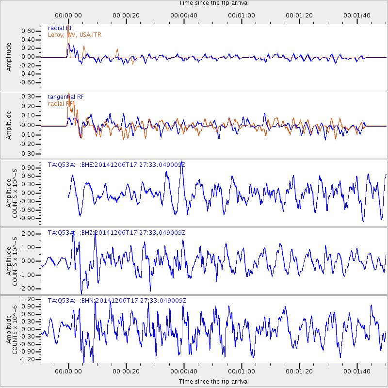
Q53A Leroy, WV, USA - Earthquake Result Viewer
*The percent match for this event was below the threshold and hence no stack was calculated.
| Earthquake location: |
South Of Panama |
| Earthquake latitude/longitude: |
8.0/-82.7 |
| Earthquake time(UTC): |
2014/12/06 (340) 17:21:48 GMT |
| Earthquake Depth: |
14 km |
| Earthquake Magnitude: |
6.0 MWW, 5.8 MWB, 6.0 MWC |
| Earthquake Catalog/Contributor: |
NEIC PDE/NEIC COMCAT |
|
| Network: |
TA USArray Transportable Network (new EarthScope stations) |
| Station: |
Q53A Leroy, WV, USA |
| Lat/Lon: |
38.86 N/81.53 W |
| Elevation: |
310 m |
|
| Distance: |
30.8 deg |
| Az: |
1.818 deg |
| Baz: |
182.307 deg |
| Ray Param: |
$rayparam |
*The percent match for this event was below the threshold and hence was not used in the summary stack. |
|
| Radial Match: |
63.879814 % |
| Radial Bump: |
400 |
| Transverse Match: |
49.273182 % |
| Transverse Bump: |
396 |
| SOD ConfigId: |
821842 |
| Insert Time: |
2014-12-20 17:57:59.902 +0000 |
| GWidth: |
2.5 |
| Max Bumps: |
400 |
| Tol: |
0.001 |
|
Signal To Noise
| Channel | StoN | STA | LTA |
| TA:Q53A: :BHZ:20141206T17:27:33.049009Z | 3.1854463 | 1.1480786E-6 | 3.6041374E-7 |
| TA:Q53A: :BHN:20141206T17:27:33.049009Z | 2.420967 | 4.5034272E-7 | 1.860177E-7 |
| TA:Q53A: :BHE:20141206T17:27:33.049009Z | 1.2722863 | 3.5026247E-7 | 2.753016E-7 |
| Arrivals |
| Ps | |
| PpPs | |
| PsPs/PpSs | |


