You are here: Home > Network List > UW - Pacific Northwest Regional Seismic Network Stations List
> Station MRBL Marblemount, WA, USA > Earthquake Result Viewer
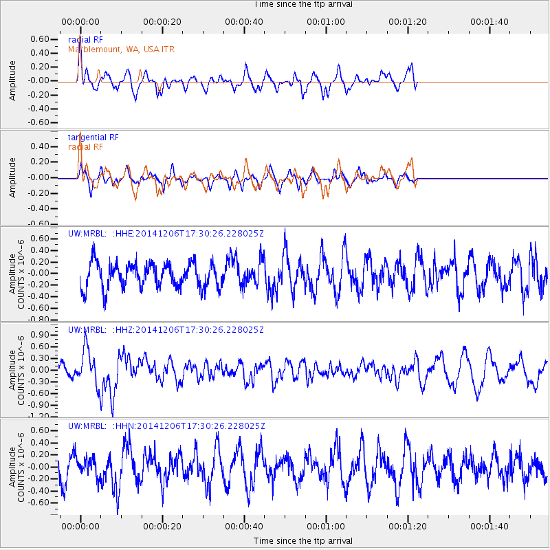
MRBL Marblemount, WA, USA - Earthquake Result Viewer
*The percent match for this event was below the threshold and hence no stack was calculated.
| Earthquake location: |
South Of Panama |
| Earthquake latitude/longitude: |
8.0/-82.7 |
| Earthquake time(UTC): |
2014/12/06 (340) 17:21:48 GMT |
| Earthquake Depth: |
14 km |
| Earthquake Magnitude: |
6.0 MWW, 5.8 MWB, 6.0 MWC |
| Earthquake Catalog/Contributor: |
NEIC PDE/NEIC COMCAT |
|
| Network: |
UW Pacific Northwest Regional Seismic Network |
| Station: |
MRBL Marblemount, WA, USA |
| Lat/Lon: |
48.52 N/121.48 W |
| Elevation: |
75 m |
|
| Distance: |
51.9 deg |
| Az: |
328.077 deg |
| Baz: |
128.029 deg |
| Ray Param: |
$rayparam |
*The percent match for this event was below the threshold and hence was not used in the summary stack. |
|
| Radial Match: |
57.2795 % |
| Radial Bump: |
400 |
| Transverse Match: |
47.45533 % |
| Transverse Bump: |
323 |
| SOD ConfigId: |
821842 |
| Insert Time: |
2014-12-20 18:03:36.701 +0000 |
| GWidth: |
2.5 |
| Max Bumps: |
400 |
| Tol: |
0.001 |
|
Signal To Noise
| Channel | StoN | STA | LTA |
| UW:MRBL: :HHZ:20141206T17:30:26.228025Z | 3.1585877 | 4.7504443E-7 | 1.5039774E-7 |
| UW:MRBL: :HHN:20141206T17:30:26.228025Z | 0.59383756 | 1.4089218E-7 | 2.3725711E-7 |
| UW:MRBL: :HHE:20141206T17:30:26.228025Z | 0.9354399 | 2.043105E-7 | 2.1841113E-7 |
| Arrivals |
| Ps | |
| PpPs | |
| PsPs/PpSs | |


