You are here: Home > Network List > TA - USArray Transportable Network (new EarthScope stations) Stations List
> Station E64A Bridgewater, ME, USA > Earthquake Result Viewer
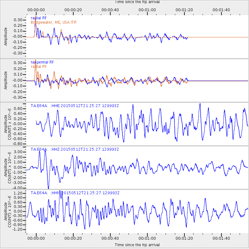
E64A Bridgewater, ME, USA - Earthquake Result Viewer
*The percent match for this event was below the threshold and hence no stack was calculated.
| Earthquake location: |
Near East Coast Of Honshu, Japan |
| Earthquake latitude/longitude: |
38.9/142.0 |
| Earthquake time(UTC): |
2015/05/12 (132) 21:12:58 GMT |
| Earthquake Depth: |
39 km |
| Earthquake Magnitude: |
6.8 MWP, 6.8 MI |
| Earthquake Catalog/Contributor: |
NEIC PDE/NEIC COMCAT |
|
| Network: |
TA USArray Transportable Network (new EarthScope stations) |
| Station: |
E64A Bridgewater, ME, USA |
| Lat/Lon: |
46.42 N/67.83 W |
| Elevation: |
190 m |
|
| Distance: |
90.9 deg |
| Az: |
20.151 deg |
| Baz: |
337.136 deg |
| Ray Param: |
$rayparam |
*The percent match for this event was below the threshold and hence was not used in the summary stack. |
|
| Radial Match: |
75.72167 % |
| Radial Bump: |
280 |
| Transverse Match: |
54.222847 % |
| Transverse Bump: |
370 |
| SOD ConfigId: |
7422571 |
| Insert Time: |
2019-04-18 20:49:49.313 +0000 |
| GWidth: |
2.5 |
| Max Bumps: |
400 |
| Tol: |
0.001 |
|
Signal To Noise
| Channel | StoN | STA | LTA |
| TA:E64A: :HHZ:20150512T21:25:27.129993Z | 5.9436345 | 1.5050829E-6 | 2.5322603E-7 |
| TA:E64A: :HHN:20150512T21:25:27.129993Z | 1.4545982 | 3.8828114E-7 | 2.6693363E-7 |
| TA:E64A: :HHE:20150512T21:25:27.129993Z | 1.2779144 | 2.6511458E-7 | 2.0745878E-7 |
| Arrivals |
| Ps | |
| PpPs | |
| PsPs/PpSs | |


