You are here: Home > Network List > TA - USArray Transportable Network (new EarthScope stations) Stations List
> Station J61A Chester, VT, USA > Earthquake Result Viewer
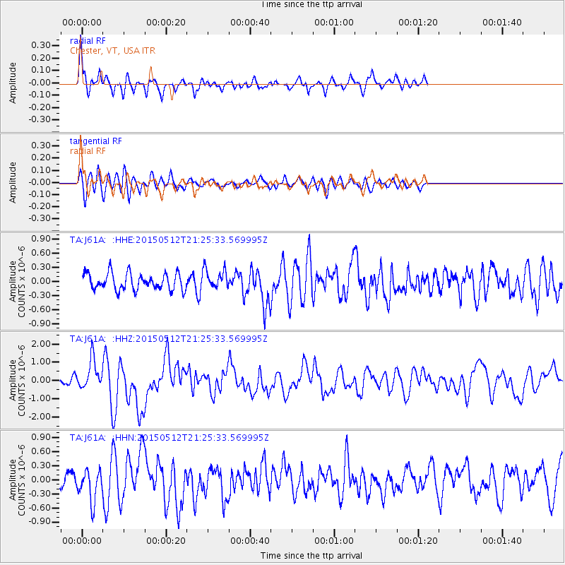
J61A Chester, VT, USA - Earthquake Result Viewer
*The percent match for this event was below the threshold and hence no stack was calculated.
| Earthquake location: |
Near East Coast Of Honshu, Japan |
| Earthquake latitude/longitude: |
38.9/142.0 |
| Earthquake time(UTC): |
2015/05/12 (132) 21:12:58 GMT |
| Earthquake Depth: |
39 km |
| Earthquake Magnitude: |
6.8 MWP, 6.8 MI |
| Earthquake Catalog/Contributor: |
NEIC PDE/NEIC COMCAT |
|
| Network: |
TA USArray Transportable Network (new EarthScope stations) |
| Station: |
J61A Chester, VT, USA |
| Lat/Lon: |
43.35 N/72.55 W |
| Elevation: |
253 m |
|
| Distance: |
92.3 deg |
| Az: |
24.485 deg |
| Baz: |
333.686 deg |
| Ray Param: |
$rayparam |
*The percent match for this event was below the threshold and hence was not used in the summary stack. |
|
| Radial Match: |
77.243256 % |
| Radial Bump: |
372 |
| Transverse Match: |
70.605774 % |
| Transverse Bump: |
400 |
| SOD ConfigId: |
7422571 |
| Insert Time: |
2019-04-18 20:50:33.471 +0000 |
| GWidth: |
2.5 |
| Max Bumps: |
400 |
| Tol: |
0.001 |
|
Signal To Noise
| Channel | StoN | STA | LTA |
| TA:J61A: :HHZ:20150512T21:25:33.569995Z | 4.1822157 | 8.427608E-7 | 2.0151062E-7 |
| TA:J61A: :HHN:20150512T21:25:33.569995Z | 1.7289892 | 3.4588254E-7 | 2.0004899E-7 |
| TA:J61A: :HHE:20150512T21:25:33.569995Z | 0.9571057 | 1.6872043E-7 | 1.7628193E-7 |
| Arrivals |
| Ps | |
| PpPs | |
| PsPs/PpSs | |


