You are here: Home > Network List > CI - Caltech Regional Seismic Network Stations List
> Station MPM Manuel Prospect Mine, California, USA > Earthquake Result Viewer
MPM Manuel Prospect Mine, California, USA - Earthquake Result Viewer
*The percent match for this event was below the threshold and hence no stack was calculated.
| Earthquake location: |
Solomon Islands |
| Earthquake latitude/longitude: |
-6.5/154.5 |
| Earthquake time(UTC): |
2014/12/07 (341) 01:22:00 GMT |
| Earthquake Depth: |
10 km |
| Earthquake Magnitude: |
6.8 MWP, 6.7 MI, 6.8 MI |
| Earthquake Catalog/Contributor: |
NEIC PDE/NEIC COMCAT |
|
| Network: |
CI Caltech Regional Seismic Network |
| Station: |
MPM Manuel Prospect Mine, California, USA |
| Lat/Lon: |
36.06 N/117.49 W |
| Elevation: |
185 m |
|
| Distance: |
92.2 deg |
| Az: |
54.14 deg |
| Baz: |
263.6 deg |
| Ray Param: |
$rayparam |
*The percent match for this event was below the threshold and hence was not used in the summary stack. |
|
| Radial Match: |
70.01387 % |
| Radial Bump: |
400 |
| Transverse Match: |
69.93607 % |
| Transverse Bump: |
400 |
| SOD ConfigId: |
822761 |
| Insert Time: |
2014-12-21 01:34:53.928 +0000 |
| GWidth: |
2.5 |
| Max Bumps: |
400 |
| Tol: |
0.001 |
|
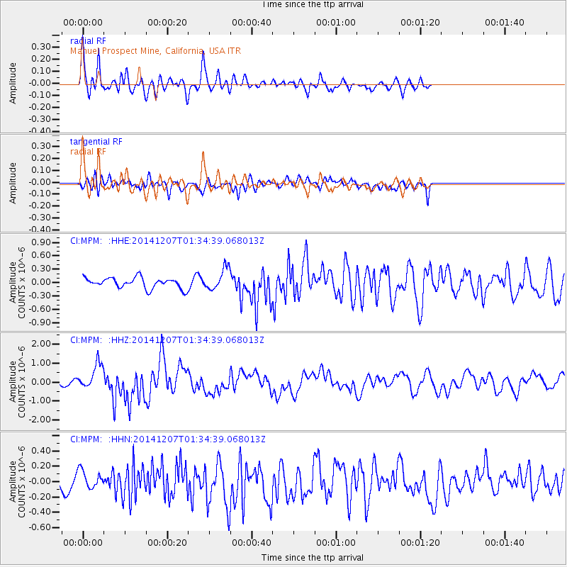
Signal To Noise
| Channel | StoN | STA | LTA |
| CI:MPM: :HHZ:20141207T01:34:39.068013Z | 4.59362 | 6.9931906E-7 | 1.5223704E-7 |
| CI:MPM: :HHN:20141207T01:34:39.068013Z | 1.3424622 | 1.1707718E-7 | 8.721078E-8 |
| CI:MPM: :HHE:20141207T01:34:39.068013Z | 2.0656855 | 2.4484504E-7 | 1.1852968E-7 |
| Arrivals |
| Ps | |
| PpPs | |
| PsPs/PpSs | |


