You are here: Home > Network List > UW - Pacific Northwest Regional Seismic Network Stations List
> Station MRBL Marblemount, WA, USA > Earthquake Result Viewer
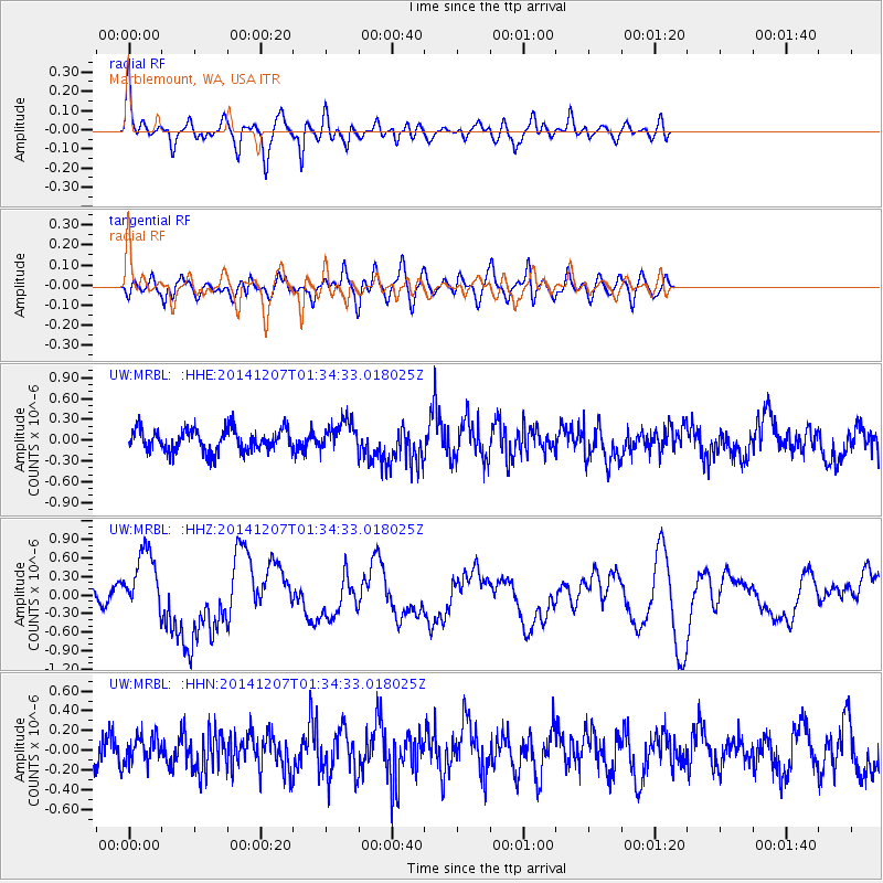
MRBL Marblemount, WA, USA - Earthquake Result Viewer
*The percent match for this event was below the threshold and hence no stack was calculated.
| Earthquake location: |
Solomon Islands |
| Earthquake latitude/longitude: |
-6.5/154.5 |
| Earthquake time(UTC): |
2014/12/07 (341) 01:22:00 GMT |
| Earthquake Depth: |
10 km |
| Earthquake Magnitude: |
6.8 MWP, 6.7 MI, 6.8 MI |
| Earthquake Catalog/Contributor: |
NEIC PDE/NEIC COMCAT |
|
| Network: |
UW Pacific Northwest Regional Seismic Network |
| Station: |
MRBL Marblemount, WA, USA |
| Lat/Lon: |
48.52 N/121.48 W |
| Elevation: |
75 m |
|
| Distance: |
90.9 deg |
| Az: |
41.406 deg |
| Baz: |
261.257 deg |
| Ray Param: |
$rayparam |
*The percent match for this event was below the threshold and hence was not used in the summary stack. |
|
| Radial Match: |
72.970345 % |
| Radial Bump: |
400 |
| Transverse Match: |
58.29912 % |
| Transverse Bump: |
400 |
| SOD ConfigId: |
822761 |
| Insert Time: |
2014-12-21 01:50:33.477 +0000 |
| GWidth: |
2.5 |
| Max Bumps: |
400 |
| Tol: |
0.001 |
|
Signal To Noise
| Channel | StoN | STA | LTA |
| UW:MRBL: :HHZ:20141207T01:34:33.018025Z | 3.6266642 | 5.2827625E-7 | 1.4566452E-7 |
| UW:MRBL: :HHN:20141207T01:34:33.018025Z | 0.84338206 | 1.3652495E-7 | 1.6187794E-7 |
| UW:MRBL: :HHE:20141207T01:34:33.018025Z | 1.3298844 | 2.1345684E-7 | 1.6050781E-7 |
| Arrivals |
| Ps | |
| PpPs | |
| PsPs/PpSs | |


