You are here: Home > Network List > UW - Pacific Northwest Regional Seismic Network Stations List
> Station UMAT Pilot Rock, OR, USA > Earthquake Result Viewer
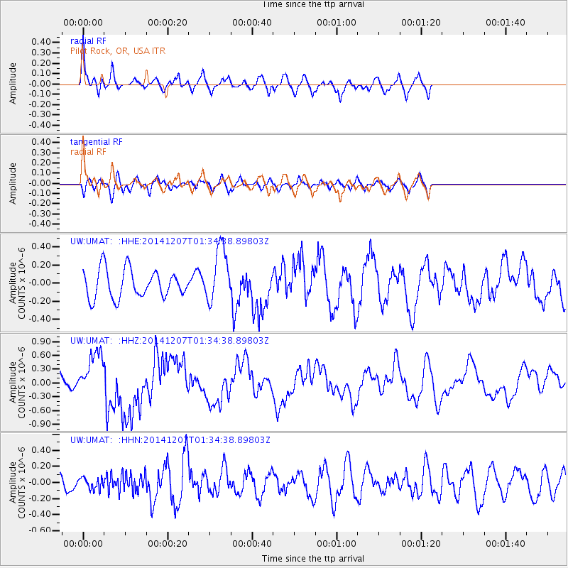
UMAT Pilot Rock, OR, USA - Earthquake Result Viewer
*The percent match for this event was below the threshold and hence no stack was calculated.
| Earthquake location: |
Solomon Islands |
| Earthquake latitude/longitude: |
-6.5/154.5 |
| Earthquake time(UTC): |
2014/12/07 (341) 01:22:00 GMT |
| Earthquake Depth: |
10 km |
| Earthquake Magnitude: |
6.8 MWP, 6.7 MI, 6.8 MI |
| Earthquake Catalog/Contributor: |
NEIC PDE/NEIC COMCAT |
|
| Network: |
UW Pacific Northwest Regional Seismic Network |
| Station: |
UMAT Pilot Rock, OR, USA |
| Lat/Lon: |
45.29 N/118.96 W |
| Elevation: |
1318 m |
|
| Distance: |
92.2 deg |
| Az: |
44.843 deg |
| Baz: |
263.002 deg |
| Ray Param: |
$rayparam |
*The percent match for this event was below the threshold and hence was not used in the summary stack. |
|
| Radial Match: |
70.01091 % |
| Radial Bump: |
354 |
| Transverse Match: |
42.5905 % |
| Transverse Bump: |
362 |
| SOD ConfigId: |
822761 |
| Insert Time: |
2014-12-21 01:50:53.494 +0000 |
| GWidth: |
2.5 |
| Max Bumps: |
400 |
| Tol: |
0.001 |
|
Signal To Noise
| Channel | StoN | STA | LTA |
| UW:UMAT: :HHZ:20141207T01:34:38.89803Z | 3.4452055 | 4.9898114E-7 | 1.4483348E-7 |
| UW:UMAT: :HHN:20141207T01:34:38.89803Z | 0.63608444 | 7.0862484E-8 | 1.1140421E-7 |
| UW:UMAT: :HHE:20141207T01:34:38.89803Z | 2.0071507 | 3.1348912E-7 | 1.5618615E-7 |
| Arrivals |
| Ps | |
| PpPs | |
| PsPs/PpSs | |


