You are here: Home > Network List > CN - Canadian National Seismograph Network Stations List
> Station INK INUVIK, NT > Earthquake Result Viewer
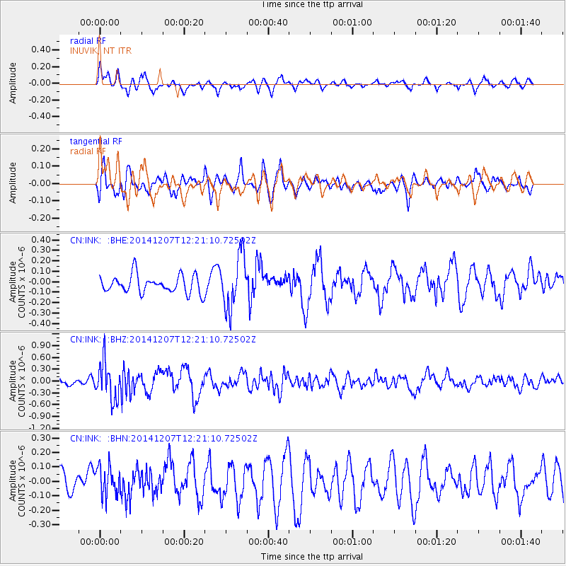
INK INUVIK, NT - Earthquake Result Viewer
*The percent match for this event was below the threshold and hence no stack was calculated.
| Earthquake location: |
Near Coast Of Guatemala |
| Earthquake latitude/longitude: |
13.8/-91.4 |
| Earthquake time(UTC): |
2014/12/07 (341) 12:11:33 GMT |
| Earthquake Depth: |
43 km |
| Earthquake Magnitude: |
5.6 MB |
| Earthquake Catalog/Contributor: |
NEIC PDE/NEIC COMCAT |
|
| Network: |
CN Canadian National Seismograph Network |
| Station: |
INK INUVIK, NT |
| Lat/Lon: |
68.31 N/133.53 W |
| Elevation: |
44 m |
|
| Distance: |
60.8 deg |
| Az: |
343.412 deg |
| Baz: |
131.742 deg |
| Ray Param: |
$rayparam |
*The percent match for this event was below the threshold and hence was not used in the summary stack. |
|
| Radial Match: |
63.7858 % |
| Radial Bump: |
400 |
| Transverse Match: |
61.92968 % |
| Transverse Bump: |
400 |
| SOD ConfigId: |
823428 |
| Insert Time: |
2014-12-21 12:32:34.192 +0000 |
| GWidth: |
2.5 |
| Max Bumps: |
400 |
| Tol: |
0.001 |
|
Signal To Noise
| Channel | StoN | STA | LTA |
| CN:INK: :BHZ:20141207T12:21:10.72502Z | 3.2506313 | 4.8906435E-7 | 1.5045211E-7 |
| CN:INK: :BHN:20141207T12:21:10.72502Z | 0.91426045 | 1.0251648E-7 | 1.121305E-7 |
| CN:INK: :BHE:20141207T12:21:10.72502Z | 3.1050274 | 2.619201E-7 | 8.435355E-8 |
| Arrivals |
| Ps | |
| PpPs | |
| PsPs/PpSs | |


