TIXI Tiksi, Russia - Earthquake Result Viewer
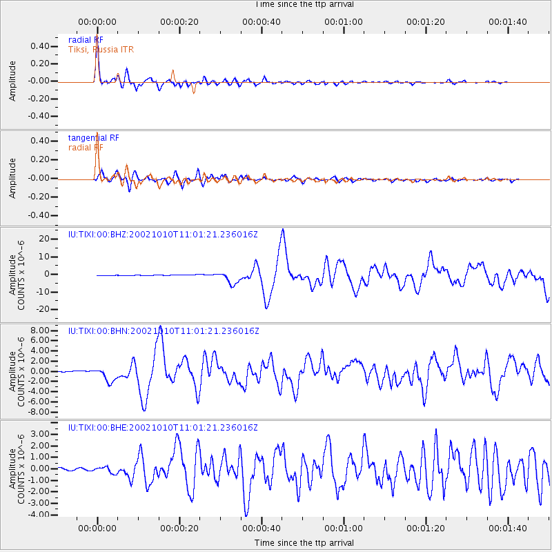
Earthquake location: Irian Jaya Region, Indonesia
Earthquake latitude/longitude: -1.8/134.3
Earthquake time(UTC): 2002/10/10 (283) 10:50:20 GMT
Earthquake Depth: 10 km
Earthquake Magnitude: 6.5 MB, 7.7 MS, 7.6 MW, 7.4 MW
Earthquake Catalog/Contributor: WHDF/NEIC
Network: IU Global Seismograph Network (GSN - IRIS/USGS)
Station: TIXI Tiksi, Russia
Lat/Lon: 71.65 N/128.87 E
Elevation: 50 m
Distance: 73.4 deg
Az: 358.207 deg
Baz: 174.334 deg
Ray Param: 0.053053293
Estimated Moho Depth: 17.5 km
Estimated Crust Vp/Vs: 1.85
Assumed Crust Vp: 6.552 km/s
Estimated Crust Vs: 3.542 km/s
Estimated Crust Poisson's Ratio: 0.29
Radial Match: 96.108604 %
Radial Bump: 400
Transverse Match: 90.52257 %
Transverse Bump: 400
SOD ConfigId: 4714
Insert Time: 2010-03-02 14:40:10.250 +0000
GWidth: 2.5
Max Bumps: 400
Tol: 0.001

Signal To Noise

ChannelStoNSTALTA
IU:TIXI:00:BHN:20021010T11:01:21.236016Z15.2583211.4017868E-69.187031E-8
IU:TIXI:00:BHE:20021010T11:01:21.236016Z2.90086942.739969E-79.445338E-8
IU:TIXI:00:BHZ:20021010T11:01:21.236016Z17.825733.713469E-62.0832073E-7
Arrivals
Ps2.3 SECOND
PpPs7.4 SECOND
PsPs/PpSs9.7 SECOND