You are here: Home > Network List > TA - USArray Transportable Network (new EarthScope stations) Stations List
> Station 121A Cookes Peak, Deming, NM, USA > Earthquake Result Viewer
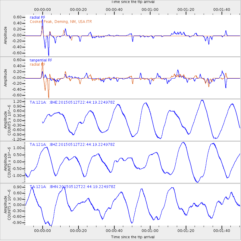
121A Cookes Peak, Deming, NM, USA - Earthquake Result Viewer
*The percent match for this event was below the threshold and hence no stack was calculated.
| Earthquake location: |
Vanuatu Islands Region |
| Earthquake latitude/longitude: |
-20.6/174.7 |
| Earthquake time(UTC): |
2015/05/12 (132) 22:31:45 GMT |
| Earthquake Depth: |
0.0 km |
| Earthquake Magnitude: |
3.8 mb, 5.9 ML, 4.0 mbtmp, 3.8 mb1mx, 4.1 mb1 |
| Earthquake Catalog/Contributor: |
ISC/ISC |
|
| Network: |
TA USArray Transportable Network (new EarthScope stations) |
| Station: |
121A Cookes Peak, Deming, NM, USA |
| Lat/Lon: |
32.53 N/107.79 W |
| Elevation: |
1652 m |
|
| Distance: |
91.0 deg |
| Az: |
55.586 deg |
| Baz: |
246.173 deg |
| Ray Param: |
$rayparam |
*The percent match for this event was below the threshold and hence was not used in the summary stack. |
|
| Radial Match: |
79.26416 % |
| Radial Bump: |
325 |
| Transverse Match: |
63.03363 % |
| Transverse Bump: |
400 |
| SOD ConfigId: |
7422571 |
| Insert Time: |
2019-04-18 21:01:50.715 +0000 |
| GWidth: |
2.5 |
| Max Bumps: |
400 |
| Tol: |
0.001 |
|
Signal To Noise
| Channel | StoN | STA | LTA |
| TA:121A: :BHZ:20150512T22:44:19.224978Z | 1.5937338 | 9.5326686E-7 | 5.981343E-7 |
| TA:121A: :BHN:20150512T22:44:19.224978Z | 1.4275838 | 8.340405E-7 | 5.842322E-7 |
| TA:121A: :BHE:20150512T22:44:19.224978Z | 1.2832896 | 5.536733E-7 | 4.3144848E-7 |
| Arrivals |
| Ps | |
| PpPs | |
| PsPs/PpSs | |


