You are here: Home > Network List > WY - Yellowstone Wyoming Seismic Network Stations List
> Station YHH Holmes Hill, YNP, WY, USA > Earthquake Result Viewer
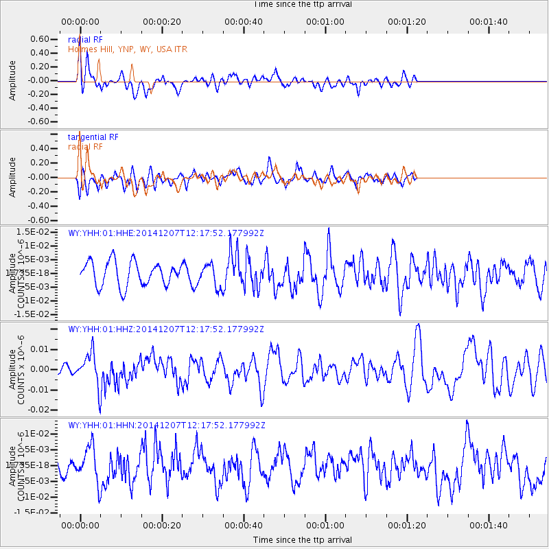
YHH Holmes Hill, YNP, WY, USA - Earthquake Result Viewer
*The percent match for this event was below the threshold and hence no stack was calculated.
| Earthquake location: |
Near Coast Of Guatemala |
| Earthquake latitude/longitude: |
13.8/-91.4 |
| Earthquake time(UTC): |
2014/12/07 (341) 12:11:33 GMT |
| Earthquake Depth: |
43 km |
| Earthquake Magnitude: |
5.6 MB |
| Earthquake Catalog/Contributor: |
NEIC PDE/NEIC COMCAT |
|
| Network: |
WY Yellowstone Wyoming Seismic Network |
| Station: |
YHH Holmes Hill, YNP, WY, USA |
| Lat/Lon: |
44.79 N/110.85 W |
| Elevation: |
2717 m |
|
| Distance: |
35.1 deg |
| Az: |
335.653 deg |
| Baz: |
145.767 deg |
| Ray Param: |
$rayparam |
*The percent match for this event was below the threshold and hence was not used in the summary stack. |
|
| Radial Match: |
64.41979 % |
| Radial Bump: |
400 |
| Transverse Match: |
62.181286 % |
| Transverse Bump: |
400 |
| SOD ConfigId: |
823428 |
| Insert Time: |
2014-12-21 12:52:43.490 +0000 |
| GWidth: |
2.5 |
| Max Bumps: |
400 |
| Tol: |
0.001 |
|
Signal To Noise
| Channel | StoN | STA | LTA |
| WY:YHH:01:HHZ:20141207T12:17:52.177992Z | 2.8322856 | 8.019362E-9 | 2.83141E-9 |
| WY:YHH:01:HHN:20141207T12:17:52.177992Z | 1.7607591 | 5.6222578E-9 | 3.1930874E-9 |
| WY:YHH:01:HHE:20141207T12:17:52.177992Z | 0.95507264 | 4.2279753E-9 | 4.4268624E-9 |
| Arrivals |
| Ps | |
| PpPs | |
| PsPs/PpSs | |


