TIXI Tiksi, Russia - Earthquake Result Viewer
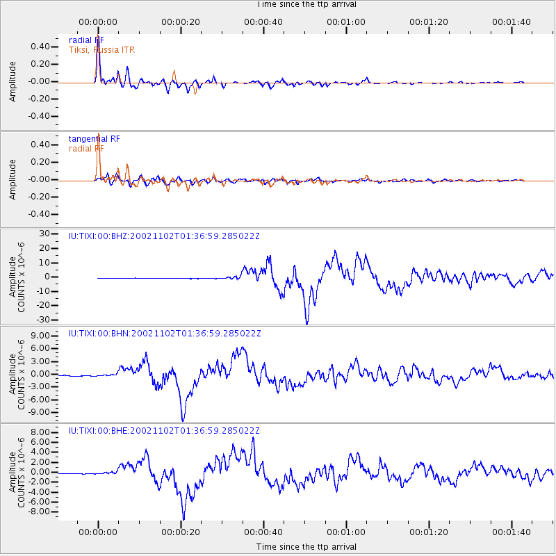
Earthquake location: Northern Sumatra, Indonesia
Earthquake latitude/longitude: 2.8/96.1
Earthquake time(UTC): 2002/11/02 (306) 01:26:10 GMT
Earthquake Depth: 30 km
Earthquake Magnitude: 6.2 MB, 7.6 MS, 7.4 MW, 7.4 MW
Earthquake Catalog/Contributor: WHDF/NEIC
Network: IU Global Seismograph Network (GSN - IRIS/USGS)
Station: TIXI Tiksi, Russia
Lat/Lon: 71.65 N/128.87 E
Elevation: 50 m
Distance: 71.8 deg
Az: 10.401 deg
Baz: 214.7 deg
Ray Param: 0.054046363
Estimated Moho Depth: 16.5 km
Estimated Crust Vp/Vs: 1.94
Assumed Crust Vp: 6.552 km/s
Estimated Crust Vs: 3.378 km/s
Estimated Crust Poisson's Ratio: 0.32
Radial Match: 98.95198 %
Radial Bump: 350
Transverse Match: 93.37619 %
Transverse Bump: 400
SOD ConfigId: 4714
Insert Time: 2010-03-02 14:40:28.076 +0000
GWidth: 2.5
Max Bumps: 400
Tol: 0.001

Signal To Noise

ChannelStoNSTALTA
IU:TIXI:00:BHN:20021102T01:36:59.285022Z1.39736952.3502984E-71.6819449E-7
IU:TIXI:00:BHE:20021102T01:36:59.285022Z4.5293093.016326E-76.6595724E-8
IU:TIXI:00:BHZ:20021102T01:36:59.285022Z9.392651.1224092E-61.1949868E-7
Arrivals
Ps2.4 SECOND
PpPs7.2 SECOND
PsPs/PpSs9.6 SECOND