You are here: Home > Network List > AZ - ANZA Regional Network Stations List
> Station SMER AZ.SMER > Earthquake Result Viewer
SMER AZ.SMER - Earthquake Result Viewer
*The percent match for this event was below the threshold and hence no stack was calculated.
| Earthquake location: |
Near Coast Of Guatemala |
| Earthquake latitude/longitude: |
13.7/-91.4 |
| Earthquake time(UTC): |
2014/12/07 (341) 21:16:37 GMT |
| Earthquake Depth: |
33 km |
| Earthquake Magnitude: |
5.8 MWB |
| Earthquake Catalog/Contributor: |
NEIC PDE/NEIC COMCAT |
|
| Network: |
AZ ANZA Regional Network |
| Station: |
SMER AZ.SMER |
| Lat/Lon: |
33.46 N/117.17 W |
| Elevation: |
355 m |
|
| Distance: |
30.5 deg |
| Az: |
314.413 deg |
| Baz: |
123.867 deg |
| Ray Param: |
$rayparam |
*The percent match for this event was below the threshold and hence was not used in the summary stack. |
|
| Radial Match: |
63.461597 % |
| Radial Bump: |
271 |
| Transverse Match: |
47.41443 % |
| Transverse Bump: |
400 |
| SOD ConfigId: |
823789 |
| Insert Time: |
2014-12-21 21:32:35.392 +0000 |
| GWidth: |
2.5 |
| Max Bumps: |
400 |
| Tol: |
0.001 |
|
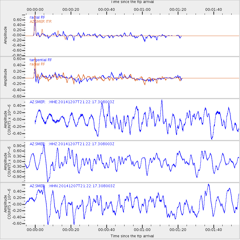
Signal To Noise
| Channel | StoN | STA | LTA |
| AZ:SMER: :HHZ:20141207T21:22:17.308003Z | 2.649363 | 4.182429E-7 | 1.5786547E-7 |
| AZ:SMER: :HHN:20141207T21:22:17.308003Z | 3.744688 | 4.1679237E-7 | 1.113023E-7 |
| AZ:SMER: :HHE:20141207T21:22:17.308003Z | 1.7119241 | 1.989575E-7 | 1.1621864E-7 |
| Arrivals |
| Ps | |
| PpPs | |
| PsPs/PpSs | |


