
TIXI Tiksi, Russia - Earthquake Result Viewer
| ||||||||||||||||||
| ||||||||||||||||||
| ||||||||||||||||||
|
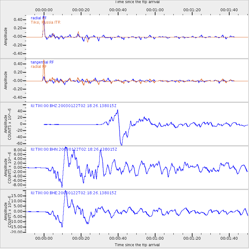
Signal To Noise
| Channel | StoN | STA | LTA |
| IU:TIXI:00:BHN:20030122T02:18:26.138015Z | 5.406449 | 6.238161E-7 | 1.15383706E-7 |
| IU:TIXI:00:BHE:20030122T02:18:26.138015Z | 11.9924555 | 1.1792256E-6 | 9.833063E-8 |
| IU:TIXI:00:BHZ:20030122T02:18:26.138015Z | 22.257784 | 3.840478E-6 | 1.7254538E-7 |
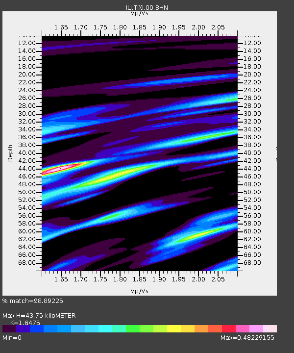
| Arrivals | |
| Ps | 4.5 SECOND |
| PpPs | 17 SECOND |
| PsPs/PpSs | 22 SECOND |

