You are here: Home > Network List > TA - USArray Transportable Network (new EarthScope stations) Stations List
> Station G03D McMinnville, OR, USA > Earthquake Result Viewer
G03D McMinnville, OR, USA - Earthquake Result Viewer
*The percent match for this event was below the threshold and hence no stack was calculated.
| Earthquake location: |
Near Coast Of Guatemala |
| Earthquake latitude/longitude: |
13.7/-91.4 |
| Earthquake time(UTC): |
2014/12/07 (341) 21:16:37 GMT |
| Earthquake Depth: |
33 km |
| Earthquake Magnitude: |
5.8 MWB |
| Earthquake Catalog/Contributor: |
NEIC PDE/NEIC COMCAT |
|
| Network: |
TA USArray Transportable Network (new EarthScope stations) |
| Station: |
G03D McMinnville, OR, USA |
| Lat/Lon: |
45.21 N/123.26 W |
| Elevation: |
222 m |
|
| Distance: |
41.4 deg |
| Az: |
325.663 deg |
| Baz: |
129.155 deg |
| Ray Param: |
$rayparam |
*The percent match for this event was below the threshold and hence was not used in the summary stack. |
|
| Radial Match: |
76.461296 % |
| Radial Bump: |
400 |
| Transverse Match: |
55.184135 % |
| Transverse Bump: |
400 |
| SOD ConfigId: |
823789 |
| Insert Time: |
2014-12-21 21:46:31.115 +0000 |
| GWidth: |
2.5 |
| Max Bumps: |
400 |
| Tol: |
0.001 |
|
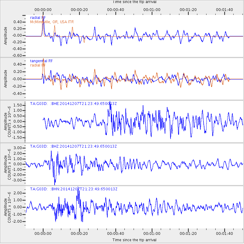
Signal To Noise
| Channel | StoN | STA | LTA |
| TA:G03D: :BHZ:20141207T21:23:49.650013Z | 2.293575 | 7.568204E-7 | 3.299741E-7 |
| TA:G03D: :BHN:20141207T21:23:49.650013Z | 0.5751781 | 2.238931E-7 | 3.8925873E-7 |
| TA:G03D: :BHE:20141207T21:23:49.650013Z | 1.4328483 | 3.6397952E-7 | 2.5402514E-7 |
| Arrivals |
| Ps | |
| PpPs | |
| PsPs/PpSs | |


