You are here: Home > Network List > UW - Pacific Northwest Regional Seismic Network Stations List
> Station LEBA Lebam, WA, USA > Earthquake Result Viewer
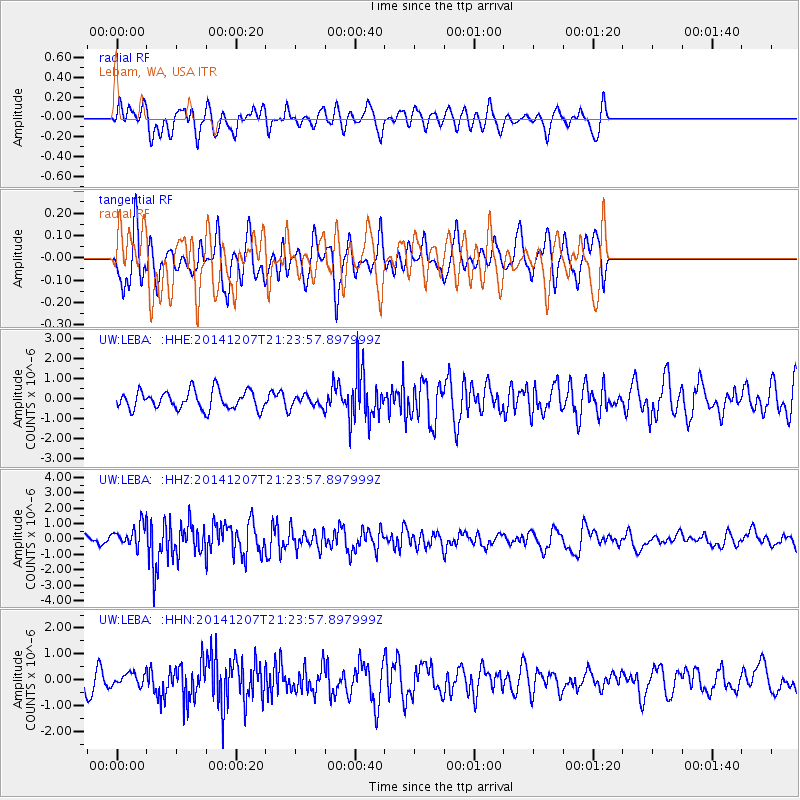
LEBA Lebam, WA, USA - Earthquake Result Viewer
*The percent match for this event was below the threshold and hence no stack was calculated.
| Earthquake location: |
Near Coast Of Guatemala |
| Earthquake latitude/longitude: |
13.7/-91.4 |
| Earthquake time(UTC): |
2014/12/07 (341) 21:16:37 GMT |
| Earthquake Depth: |
33 km |
| Earthquake Magnitude: |
5.8 MWB |
| Earthquake Catalog/Contributor: |
NEIC PDE/NEIC COMCAT |
|
| Network: |
UW Pacific Northwest Regional Seismic Network |
| Station: |
LEBA Lebam, WA, USA |
| Lat/Lon: |
46.55 N/123.56 W |
| Elevation: |
73 m |
|
| Distance: |
42.4 deg |
| Az: |
327.006 deg |
| Baz: |
129.94 deg |
| Ray Param: |
$rayparam |
*The percent match for this event was below the threshold and hence was not used in the summary stack. |
|
| Radial Match: |
61.035877 % |
| Radial Bump: |
400 |
| Transverse Match: |
54.437977 % |
| Transverse Bump: |
382 |
| SOD ConfigId: |
823789 |
| Insert Time: |
2014-12-21 21:51:58.515 +0000 |
| GWidth: |
2.5 |
| Max Bumps: |
400 |
| Tol: |
0.001 |
|
Signal To Noise
| Channel | StoN | STA | LTA |
| UW:LEBA: :HHZ:20141207T21:23:57.897999Z | 2.6679592 | 6.877837E-7 | 2.5779394E-7 |
| UW:LEBA: :HHN:20141207T21:23:57.897999Z | 0.59155357 | 2.3322629E-7 | 3.942606E-7 |
| UW:LEBA: :HHE:20141207T21:23:57.897999Z | 0.6276131 | 2.9114662E-7 | 4.6389505E-7 |
| Arrivals |
| Ps | |
| PpPs | |
| PsPs/PpSs | |


