You are here: Home > Network List > US - United States National Seismic Network Stations List
> Station CBKS Cedar Bluff, Kansas, USA > Earthquake Result Viewer
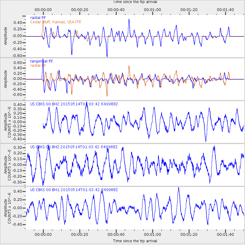
CBKS Cedar Bluff, Kansas, USA - Earthquake Result Viewer
*The percent match for this event was below the threshold and hence no stack was calculated.
| Earthquake location: |
Kuril Islands |
| Earthquake latitude/longitude: |
45.8/150.1 |
| Earthquake time(UTC): |
2015/05/14 (134) 00:52:53 GMT |
| Earthquake Depth: |
200 km |
| Earthquake Magnitude: |
3.6 mb |
| Earthquake Catalog/Contributor: |
ISC/ISC |
|
| Network: |
US United States National Seismic Network |
| Station: |
CBKS Cedar Bluff, Kansas, USA |
| Lat/Lon: |
38.81 N/99.74 W |
| Elevation: |
677 m |
|
| Distance: |
75.1 deg |
| Az: |
49.35 deg |
| Baz: |
317.203 deg |
| Ray Param: |
$rayparam |
*The percent match for this event was below the threshold and hence was not used in the summary stack. |
|
| Radial Match: |
69.539825 % |
| Radial Bump: |
400 |
| Transverse Match: |
60.57498 % |
| Transverse Bump: |
400 |
| SOD ConfigId: |
7422571 |
| Insert Time: |
2019-04-18 21:16:52.703 +0000 |
| GWidth: |
2.5 |
| Max Bumps: |
400 |
| Tol: |
0.001 |
|
Signal To Noise
| Channel | StoN | STA | LTA |
| US:CBKS:00:BHZ:20150514T01:03:42.649988Z | 1.7669147 | 2.1595878E-7 | 1.2222367E-7 |
| US:CBKS:00:BH1:20150514T01:03:42.649988Z | 0.9664023 | 1.4698813E-7 | 1.5209828E-7 |
| US:CBKS:00:BH2:20150514T01:03:42.649988Z | 0.8333145 | 1.5077411E-7 | 1.8093304E-7 |
| Arrivals |
| Ps | |
| PpPs | |
| PsPs/PpSs | |


