You are here: Home > Network List > TA - USArray Transportable Network (new EarthScope stations) Stations List
> Station I23K Minto, Yukon-Koyukuk, AK, USA > Earthquake Result Viewer
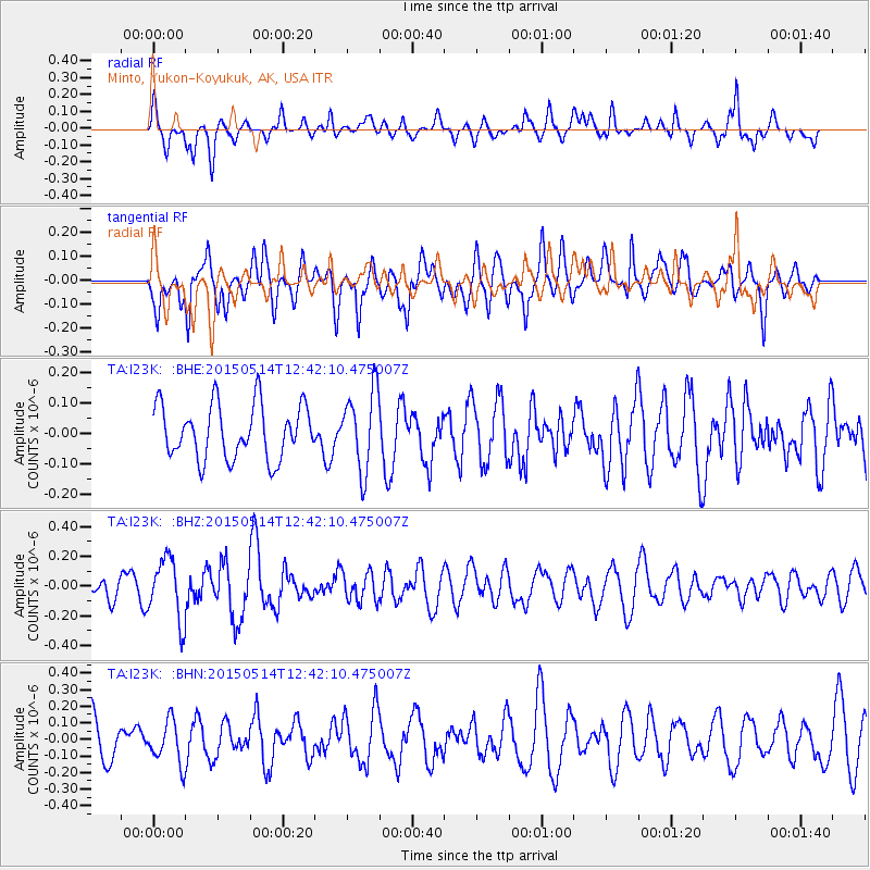
I23K Minto, Yukon-Koyukuk, AK, USA - Earthquake Result Viewer
*The percent match for this event was below the threshold and hence no stack was calculated.
| Earthquake location: |
Solomon Islands |
| Earthquake latitude/longitude: |
-7.4/154.6 |
| Earthquake time(UTC): |
2015/05/14 (134) 12:30:17 GMT |
| Earthquake Depth: |
27 km |
| Earthquake Magnitude: |
5.4 MW, 4.6 MS, 5.3 mb |
| Earthquake Catalog/Contributor: |
ISC/ISC |
|
| Network: |
TA USArray Transportable Network (new EarthScope stations) |
| Station: |
I23K Minto, Yukon-Koyukuk, AK, USA |
| Lat/Lon: |
65.15 N/149.36 W |
| Elevation: |
149 m |
|
| Distance: |
83.3 deg |
| Az: |
20.664 deg |
| Baz: |
235.901 deg |
| Ray Param: |
$rayparam |
*The percent match for this event was below the threshold and hence was not used in the summary stack. |
|
| Radial Match: |
46.002785 % |
| Radial Bump: |
279 |
| Transverse Match: |
51.784664 % |
| Transverse Bump: |
400 |
| SOD ConfigId: |
7422571 |
| Insert Time: |
2019-04-18 21:24:34.161 +0000 |
| GWidth: |
2.5 |
| Max Bumps: |
400 |
| Tol: |
0.001 |
|
Signal To Noise
| Channel | StoN | STA | LTA |
| TA:I23K: :BHZ:20150514T12:42:10.475007Z | 1.9275128 | 2.0747568E-7 | 1.0763907E-7 |
| TA:I23K: :BHN:20150514T12:42:10.475007Z | 0.8287261 | 1.280924E-7 | 1.5456541E-7 |
| TA:I23K: :BHE:20150514T12:42:10.475007Z | 1.4730842 | 1.3097348E-7 | 8.891106E-8 |
| Arrivals |
| Ps | |
| PpPs | |
| PsPs/PpSs | |


