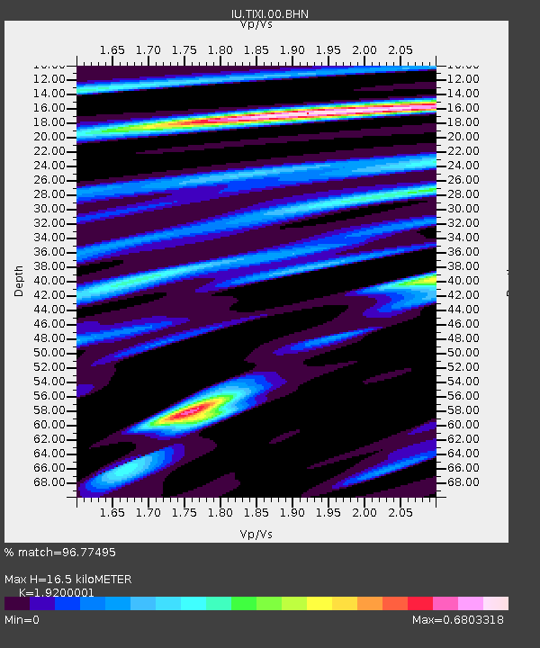
TIXI Tiksi, Russia - Earthquake Result Viewer
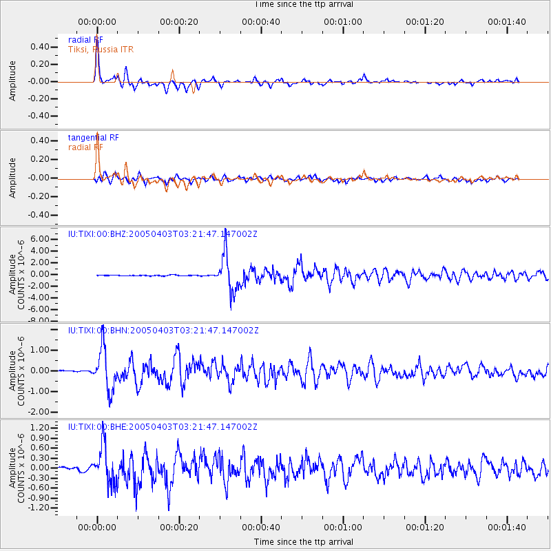
Earthquake location: Northern Sumatra, Indonesia
Earthquake latitude/longitude: 2.0/97.9
Earthquake time(UTC): 2005/04/03 (093) 03:10:56 GMT
Earthquake Depth: 36 km
Earthquake Magnitude: 6.0 MB, 5.9 MS, 6.3 MW, 6.3 MW
Earthquake Catalog/Contributor: WHDF/NEIC
Network: IU Global Seismograph Network (GSN - IRIS/USGS)
Station: TIXI Tiksi, Russia
Lat/Lon: 71.65 N/128.87 E
Elevation: 50 m
Distance: 72.3 deg
Az: 9.841 deg
Baz: 212.633 deg
Ray Param: 0.053726126
Estimated Moho Depth: 16.5 km
Estimated Crust Vp/Vs: 1.92
Assumed Crust Vp: 6.552 km/s
Estimated Crust Vs: 3.413 km/s
Estimated Crust Poisson's Ratio: 0.31
Radial Match: 96.77495 %
Radial Bump: 398
Transverse Match: 89.0038 %
Transverse Bump: 400
SOD ConfigId: 2459
Insert Time: 2010-03-02 14:45:14.555 +0000
GWidth: 2.5
Max Bumps: 400
Tol: 0.001

Signal To Noise

ChannelStoNSTALTA
IU:TIXI:00:BHN:20050403T03:21:47.147002Z22.7196711.0331698E-64.5474685E-8
IU:TIXI:00:BHE:20050403T03:21:47.147002Z11.3141765.8028786E-75.128857E-8
IU:TIXI:00:BHZ:20050403T03:21:47.147002Z46.8561483.2318692E-66.897428E-8
Arrivals
Ps2.4 SECOND
PpPs7.1 SECOND
PsPs/PpSs9.5 SECOND