TIXI Tiksi, Russia - Earthquake Result Viewer
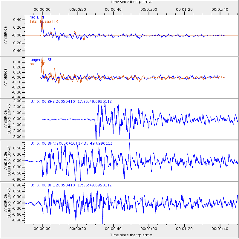
Earthquake location: Southern Sumatra, Indonesia
Earthquake latitude/longitude: -1.6/99.7
Earthquake time(UTC): 2005/04/10 (100) 17:24:39 GMT
Earthquake Depth: 30 km
Earthquake Magnitude: 5.9 MB, 6.2 MS, 6.4 MW, 6.1 MW
Earthquake Catalog/Contributor: WHDF/NEIC
Network: IU Global Seismograph Network (GSN - IRIS/USGS)
Station: TIXI Tiksi, Russia
Lat/Lon: 71.65 N/128.87 E
Elevation: 50 m
Distance: 75.5 deg
Az: 9.17 deg
Baz: 210.194 deg
Ray Param: 0.051585782
Estimated Moho Depth: 16.5 km
Estimated Crust Vp/Vs: 1.92
Assumed Crust Vp: 6.552 km/s
Estimated Crust Vs: 3.404 km/s
Estimated Crust Poisson's Ratio: 0.32
Radial Match: 96.380936 %
Radial Bump: 400
Transverse Match: 87.4408 %
Transverse Bump: 400
SOD ConfigId: 2459
Insert Time: 2010-03-02 14:45:27.355 +0000
GWidth: 2.5
Max Bumps: 400
Tol: 0.001

Signal To Noise

ChannelStoNSTALTA
IU:TIXI:00:BHN:20050410T17:35:49.699011Z10.7343163.7574083E-73.5003705E-8
IU:TIXI:00:BHE:20050410T17:35:49.699011Z8.0758513.2282622E-73.9974264E-8
IU:TIXI:00:BHZ:20050410T17:35:49.699011Z26.8991281.521601E-65.656693E-8
Arrivals
Ps2.4 SECOND
PpPs7.1 SECOND
PsPs/PpSs9.5 SECOND