
TIXI Tiksi, Russia - Earthquake Result Viewer
| ||||||||||||||||||
| ||||||||||||||||||
| ||||||||||||||||||
|
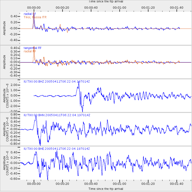
Signal To Noise
| Channel | StoN | STA | LTA |
| IU:TIXI:00:BHN:20050411T06:22:04.197014Z | 15.873422 | 4.7480455E-7 | 2.991192E-8 |
| IU:TIXI:00:BHE:20050411T06:22:04.197014Z | 12.329021 | 3.000604E-7 | 2.433773E-8 |
| IU:TIXI:00:BHZ:20050411T06:22:04.197014Z | 22.413774 | 1.5979099E-6 | 7.1291424E-8 |
| Arrivals | |
| Ps | 2.4 SECOND |
| PpPs | 7.1 SECOND |
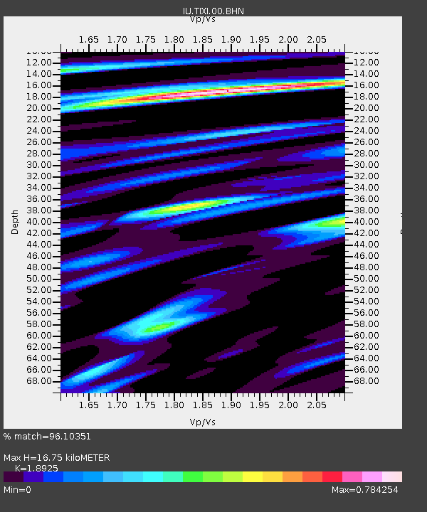
| PsPs/PpSs | 9.5 SECOND |

