You are here: Home > Network List > TA - USArray Transportable Network (new EarthScope stations) Stations List
> Station O48A Farmland, IN, USA > Earthquake Result Viewer
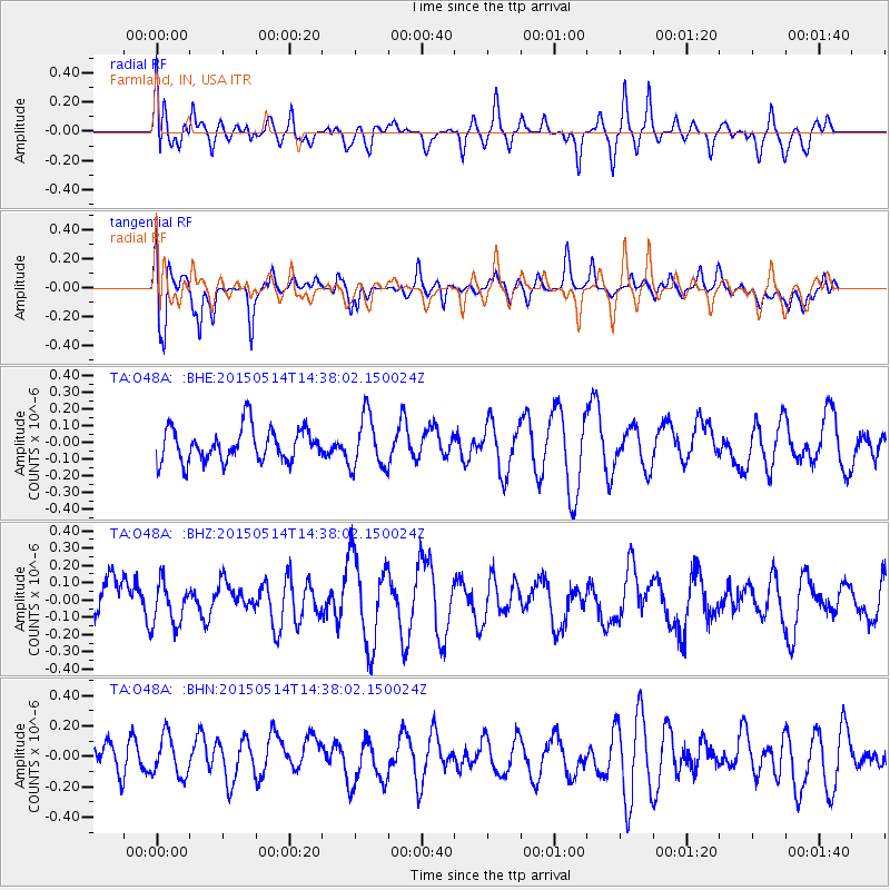
O48A Farmland, IN, USA - Earthquake Result Viewer
*The percent match for this event was below the threshold and hence no stack was calculated.
| Earthquake location: |
Hokkaido, Japan Region |
| Earthquake latitude/longitude: |
43.0/145.1 |
| Earthquake time(UTC): |
2015/05/14 (134) 14:26:04 GMT |
| Earthquake Depth: |
82 km |
| Earthquake Magnitude: |
3.5 mb |
| Earthquake Catalog/Contributor: |
ISC/ISC |
|
| Network: |
TA USArray Transportable Network (new EarthScope stations) |
| Station: |
O48A Farmland, IN, USA |
| Lat/Lon: |
40.26 N/85.16 W |
| Elevation: |
300 m |
|
| Distance: |
85.5 deg |
| Az: |
36.2 deg |
| Baz: |
325.522 deg |
| Ray Param: |
$rayparam |
*The percent match for this event was below the threshold and hence was not used in the summary stack. |
|
| Radial Match: |
51.477615 % |
| Radial Bump: |
400 |
| Transverse Match: |
71.563065 % |
| Transverse Bump: |
400 |
| SOD ConfigId: |
7422571 |
| Insert Time: |
2019-04-18 21:32:33.101 +0000 |
| GWidth: |
2.5 |
| Max Bumps: |
400 |
| Tol: |
0.001 |
|
Signal To Noise
| Channel | StoN | STA | LTA |
| TA:O48A: :BHZ:20150514T14:38:02.150024Z | 0.95193857 | 1.2425726E-7 | 1.3053075E-7 |
| TA:O48A: :BHN:20150514T14:38:02.150024Z | 0.99092734 | 1.323408E-7 | 1.3355248E-7 |
| TA:O48A: :BHE:20150514T14:38:02.150024Z | 1.59551 | 1.5930473E-7 | 9.984565E-8 |
| Arrivals |
| Ps | |
| PpPs | |
| PsPs/PpSs | |


