
TIXI Tiksi, Russia - Earthquake Result Viewer
| ||||||||||||||||||
| ||||||||||||||||||
| ||||||||||||||||||
|
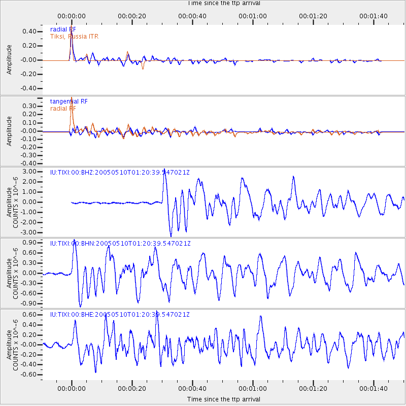
Signal To Noise
| Channel | StoN | STA | LTA |
| IU:TIXI:00:BHN:20050510T01:20:39.547021Z | 25.152567 | 5.7329726E-7 | 2.2792793E-8 |
| IU:TIXI:00:BHE:20050510T01:20:39.547021Z | 9.1630945 | 2.49335E-7 | 2.7210783E-8 |
| IU:TIXI:00:BHZ:20050510T01:20:39.547021Z | 40.432373 | 1.7591949E-6 | 4.3509562E-8 |
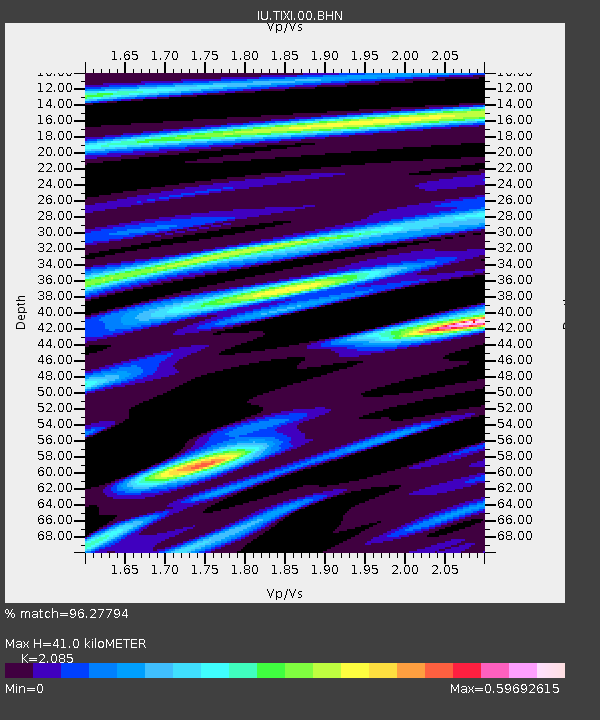
| Arrivals | |
| Ps | 7.0 SECOND |
| PpPs | 19 SECOND |
| PsPs/PpSs | 26 SECOND |

