
TIXI Tiksi, Russia - Earthquake Result Viewer
| ||||||||||||||||||
| ||||||||||||||||||
| ||||||||||||||||||
|
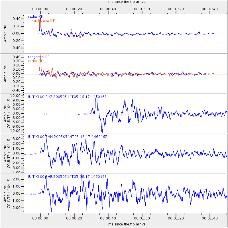
Signal To Noise
| Channel | StoN | STA | LTA |
| IU:TIXI:00:BHN:20050514T05:16:17.146016Z | 51.566513 | 1.7299619E-6 | 3.3548165E-8 |
| IU:TIXI:00:BHE:20050514T05:16:17.146016Z | 45.707516 | 1.0257627E-6 | 2.2441881E-8 |
| IU:TIXI:00:BHZ:20050514T05:16:17.146016Z | 111.26241 | 5.3339077E-6 | 4.793989E-8 |
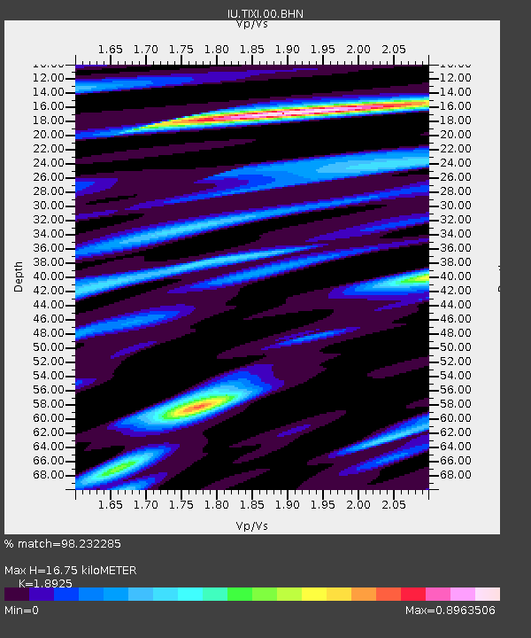
| Arrivals | |
| Ps | 2.4 SECOND |
| PpPs | 7.2 SECOND |
| PsPs/PpSs | 9.5 SECOND |

