You are here: Home > Network List > UW - Pacific Northwest Regional Seismic Network Stations List
> Station LEBA Lebam, WA, USA > Earthquake Result Viewer
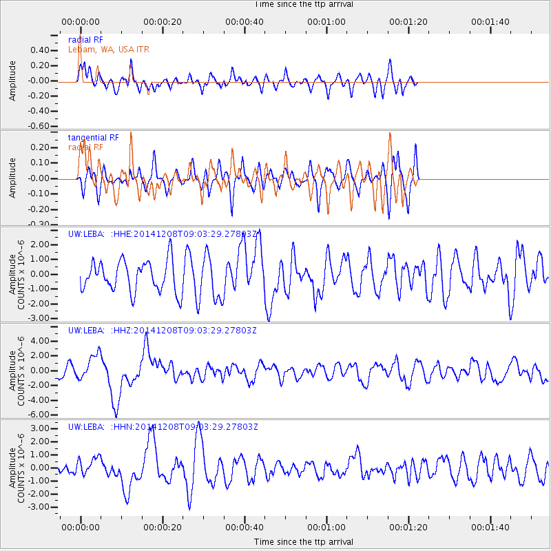
LEBA Lebam, WA, USA - Earthquake Result Viewer
*The percent match for this event was below the threshold and hence no stack was calculated.
| Earthquake location: |
South Of Panama |
| Earthquake latitude/longitude: |
8.0/-82.7 |
| Earthquake time(UTC): |
2014/12/08 (342) 08:54:52 GMT |
| Earthquake Depth: |
20 km |
| Earthquake Magnitude: |
6.6 MWW, 6.3 MWB, 6.7 MI |
| Earthquake Catalog/Contributor: |
NEIC PDE/NEIC COMCAT |
|
| Network: |
UW Pacific Northwest Regional Seismic Network |
| Station: |
LEBA Lebam, WA, USA |
| Lat/Lon: |
46.55 N/123.56 W |
| Elevation: |
73 m |
|
| Distance: |
51.9 deg |
| Az: |
324.994 deg |
| Baz: |
124.59 deg |
| Ray Param: |
$rayparam |
*The percent match for this event was below the threshold and hence was not used in the summary stack. |
|
| Radial Match: |
62.634235 % |
| Radial Bump: |
400 |
| Transverse Match: |
38.0145 % |
| Transverse Bump: |
346 |
| SOD ConfigId: |
824042 |
| Insert Time: |
2014-12-22 09:46:41.893 +0000 |
| GWidth: |
2.5 |
| Max Bumps: |
400 |
| Tol: |
0.001 |
|
Signal To Noise
| Channel | StoN | STA | LTA |
| UW:LEBA: :HHZ:20141208T09:03:29.27803Z | 3.4476633 | 1.750416E-6 | 5.077108E-7 |
| UW:LEBA: :HHN:20141208T09:03:29.27803Z | 1.0666783 | 6.7868245E-7 | 6.362579E-7 |
| UW:LEBA: :HHE:20141208T09:03:29.27803Z | 1.4583066 | 1.4990029E-6 | 1.0279066E-6 |
| Arrivals |
| Ps | |
| PpPs | |
| PsPs/PpSs | |


