You are here: Home > Network List > US - United States National Seismic Network Stations List
> Station ERPA Erie, Pennsylvania, USA > Earthquake Result Viewer
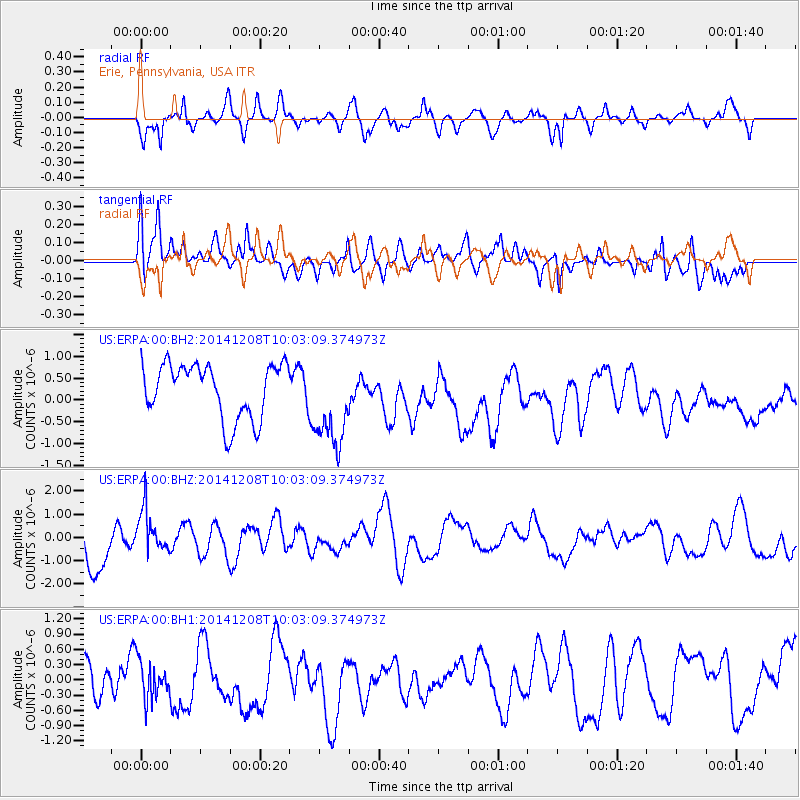
ERPA Erie, Pennsylvania, USA - Earthquake Result Viewer
*The percent match for this event was below the threshold and hence no stack was calculated.
| Earthquake location: |
East Of Kuril Islands |
| Earthquake latitude/longitude: |
50.4/158.0 |
| Earthquake time(UTC): |
2014/12/08 (342) 09:52:04 GMT |
| Earthquake Depth: |
45 km |
| Earthquake Magnitude: |
5.6 MB |
| Earthquake Catalog/Contributor: |
NEIC PDE/NEIC COMCAT |
|
| Network: |
US United States National Seismic Network |
| Station: |
ERPA Erie, Pennsylvania, USA |
| Lat/Lon: |
42.12 N/79.99 W |
| Elevation: |
306 m |
|
| Distance: |
74.9 deg |
| Az: |
40.82 deg |
| Baz: |
325.758 deg |
| Ray Param: |
$rayparam |
*The percent match for this event was below the threshold and hence was not used in the summary stack. |
|
| Radial Match: |
55.960007 % |
| Radial Bump: |
400 |
| Transverse Match: |
58.30338 % |
| Transverse Bump: |
400 |
| SOD ConfigId: |
824042 |
| Insert Time: |
2014-12-22 10:28:41.829 +0000 |
| GWidth: |
2.5 |
| Max Bumps: |
400 |
| Tol: |
0.001 |
|
Signal To Noise
| Channel | StoN | STA | LTA |
| US:ERPA:00:BHZ:20141208T10:03:09.374973Z | 1.0547037 | 9.4399394E-7 | 8.950324E-7 |
| US:ERPA:00:BH1:20141208T10:03:09.374973Z | 1.046039 | 3.6544262E-7 | 3.4935852E-7 |
| US:ERPA:00:BH2:20141208T10:03:09.374973Z | 1.6585355 | 1.0372665E-6 | 6.2541113E-7 |
| Arrivals |
| Ps | |
| PpPs | |
| PsPs/PpSs | |


