You are here: Home > Network List > US - United States National Seismic Network Stations List
> Station DGMT Dagmar, Montana, USA > Earthquake Result Viewer
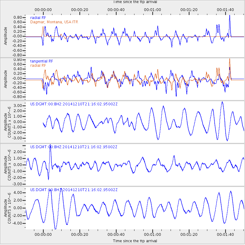
DGMT Dagmar, Montana, USA - Earthquake Result Viewer
*The percent match for this event was below the threshold and hence no stack was calculated.
| Earthquake location: |
Taiwan Region |
| Earthquake latitude/longitude: |
25.6/122.4 |
| Earthquake time(UTC): |
2014/12/10 (344) 21:03:39 GMT |
| Earthquake Depth: |
254 km |
| Earthquake Magnitude: |
6.1 MWB |
| Earthquake Catalog/Contributor: |
NEIC PDE/NEIC COMCAT |
|
| Network: |
US United States National Seismic Network |
| Station: |
DGMT Dagmar, Montana, USA |
| Lat/Lon: |
48.47 N/104.20 W |
| Elevation: |
0.0 m |
|
| Distance: |
95.3 deg |
| Az: |
29.075 deg |
| Baz: |
318.736 deg |
| Ray Param: |
$rayparam |
*The percent match for this event was below the threshold and hence was not used in the summary stack. |
|
| Radial Match: |
40.720257 % |
| Radial Bump: |
366 |
| Transverse Match: |
51.333378 % |
| Transverse Bump: |
375 |
| SOD ConfigId: |
825618 |
| Insert Time: |
2014-12-25 03:13:17.092 +0000 |
| GWidth: |
2.5 |
| Max Bumps: |
400 |
| Tol: |
0.001 |
|
Signal To Noise
| Channel | StoN | STA | LTA |
| US:DGMT:00:BHZ:20141210T21:16:02.95002Z | 2.0625508 | 1.288553E-6 | 6.2473765E-7 |
| US:DGMT:00:BH1:20141210T21:16:02.95002Z | 2.6999009 | 3.2820412E-6 | 1.2156155E-6 |
| US:DGMT:00:BH2:20141210T21:16:02.95002Z | 0.46385378 | 4.510463E-7 | 9.72389E-7 |
| Arrivals |
| Ps | |
| PpPs | |
| PsPs/PpSs | |


