You are here: Home > Network List > WY - Yellowstone Wyoming Seismic Network Stations List
> Station YHR Hawk's Rest, WY, USA > Earthquake Result Viewer
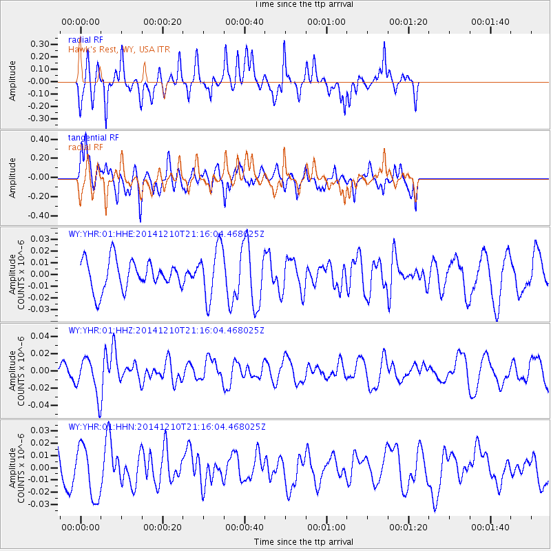
YHR Hawk's Rest, WY, USA - Earthquake Result Viewer
*The percent match for this event was below the threshold and hence no stack was calculated.
| Earthquake location: |
Taiwan Region |
| Earthquake latitude/longitude: |
25.6/122.4 |
| Earthquake time(UTC): |
2014/12/10 (344) 21:03:39 GMT |
| Earthquake Depth: |
254 km |
| Earthquake Magnitude: |
6.1 MWB |
| Earthquake Catalog/Contributor: |
NEIC PDE/NEIC COMCAT |
|
| Network: |
WY Yellowstone Wyoming Seismic Network |
| Station: |
YHR Hawk's Rest, WY, USA |
| Lat/Lon: |
44.11 N/110.08 W |
| Elevation: |
2976 m |
|
| Distance: |
95.6 deg |
| Az: |
35.066 deg |
| Baz: |
313.919 deg |
| Ray Param: |
$rayparam |
*The percent match for this event was below the threshold and hence was not used in the summary stack. |
|
| Radial Match: |
58.34705 % |
| Radial Bump: |
347 |
| Transverse Match: |
55.783585 % |
| Transverse Bump: |
400 |
| SOD ConfigId: |
825618 |
| Insert Time: |
2014-12-25 03:17:31.701 +0000 |
| GWidth: |
2.5 |
| Max Bumps: |
400 |
| Tol: |
0.001 |
|
Signal To Noise
| Channel | StoN | STA | LTA |
| WY:YHR:01:HHZ:20141210T21:16:04.468025Z | 2.1734834 | 2.1395936E-8 | 9.844076E-9 |
| WY:YHR:01:HHN:20141210T21:16:04.468025Z | 2.4909122 | 2.234119E-8 | 8.96908E-9 |
| WY:YHR:01:HHE:20141210T21:16:04.468025Z | 1.8288865 | 2.2643604E-8 | 1.2381088E-8 |
| Arrivals |
| Ps | |
| PpPs | |
| PsPs/PpSs | |


