You are here: Home > Network List > AV - Alaska Volcano Observatory Stations List
> Station MAPS Pakushin Southeast, Makushin Volcano, Alaska > Earthquake Result Viewer
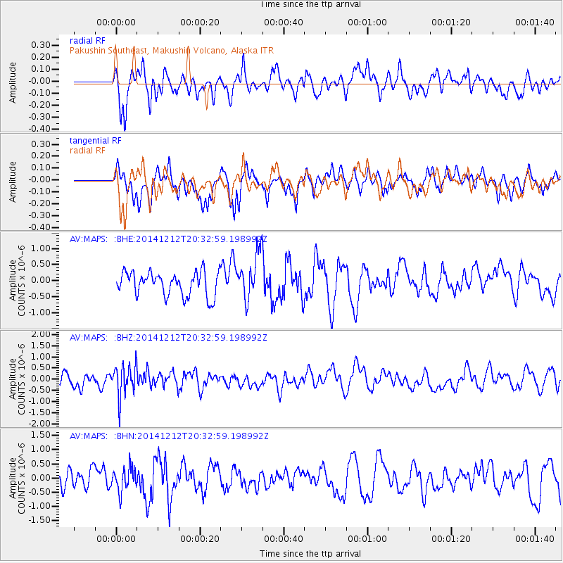
MAPS Pakushin Southeast, Makushin Volcano, Alaska - Earthquake Result Viewer
*The percent match for this event was below the threshold and hence no stack was calculated.
| Earthquake location: |
Fiji Islands Region |
| Earthquake latitude/longitude: |
-18.9/-176.4 |
| Earthquake time(UTC): |
2014/12/12 (346) 20:22:35 GMT |
| Earthquake Depth: |
317 km |
| Earthquake Magnitude: |
5.8 MWW, 5.8 MWB |
| Earthquake Catalog/Contributor: |
NEIC PDE/NEIC COMCAT |
|
| Network: |
AV Alaska Volcano Observatory |
| Station: |
MAPS Pakushin Southeast, Makushin Volcano, Alaska |
| Lat/Lon: |
53.81 N/166.94 W |
| Elevation: |
333 m |
|
| Distance: |
72.9 deg |
| Az: |
5.873 deg |
| Baz: |
189.403 deg |
| Ray Param: |
$rayparam |
*The percent match for this event was below the threshold and hence was not used in the summary stack. |
|
| Radial Match: |
51.766136 % |
| Radial Bump: |
380 |
| Transverse Match: |
51.815964 % |
| Transverse Bump: |
345 |
| SOD ConfigId: |
826047 |
| Insert Time: |
2014-12-26 20:34:03.594 +0000 |
| GWidth: |
2.5 |
| Max Bumps: |
400 |
| Tol: |
0.001 |
|
Signal To Noise
| Channel | StoN | STA | LTA |
| AV:MAPS: :BHZ:20141212T20:32:59.198992Z | 2.2067432 | 7.1676527E-7 | 3.2480682E-7 |
| AV:MAPS: :BHN:20141212T20:32:59.198992Z | 1.3719841 | 4.1884923E-7 | 3.0528724E-7 |
| AV:MAPS: :BHE:20141212T20:32:59.198992Z | 2.0515099 | 7.558089E-7 | 3.6841593E-7 |
| Arrivals |
| Ps | |
| PpPs | |
| PsPs/PpSs | |


