You are here: Home > Network List > CN - Canadian National Seismograph Network Stations List
> Station INK INUVIK, NT > Earthquake Result Viewer
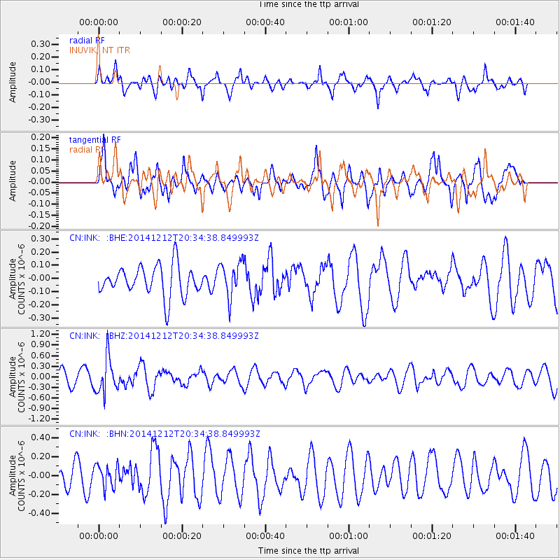
INK INUVIK, NT - Earthquake Result Viewer
*The percent match for this event was below the threshold and hence no stack was calculated.
| Earthquake location: |
Fiji Islands Region |
| Earthquake latitude/longitude: |
-18.9/-176.4 |
| Earthquake time(UTC): |
2014/12/12 (346) 20:22:35 GMT |
| Earthquake Depth: |
317 km |
| Earthquake Magnitude: |
5.8 MWW, 5.8 MWB |
| Earthquake Catalog/Contributor: |
NEIC PDE/NEIC COMCAT |
|
| Network: |
CN Canadian National Seismograph Network |
| Station: |
INK INUVIK, NT |
| Lat/Lon: |
68.31 N/133.53 W |
| Elevation: |
44 m |
|
| Distance: |
92.3 deg |
| Az: |
14.674 deg |
| Baz: |
220.175 deg |
| Ray Param: |
$rayparam |
*The percent match for this event was below the threshold and hence was not used in the summary stack. |
|
| Radial Match: |
47.223076 % |
| Radial Bump: |
400 |
| Transverse Match: |
62.11169 % |
| Transverse Bump: |
400 |
| SOD ConfigId: |
826047 |
| Insert Time: |
2014-12-26 20:40:30.521 +0000 |
| GWidth: |
2.5 |
| Max Bumps: |
400 |
| Tol: |
0.001 |
|
Signal To Noise
| Channel | StoN | STA | LTA |
| CN:INK: :BHZ:20141212T20:34:38.849993Z | 3.4443486 | 5.078407E-7 | 1.4744172E-7 |
| CN:INK: :BHN:20141212T20:34:38.849993Z | 1.2094187 | 1.2160031E-7 | 1.00544426E-7 |
| CN:INK: :BHE:20141212T20:34:38.849993Z | 1.1753894 | 1.3481421E-7 | 1.1469749E-7 |
| Arrivals |
| Ps | |
| PpPs | |
| PsPs/PpSs | |


