You are here: Home > Network List > GS - US Geological Survey Networks Stations List
> Station KAN11 Stewart Ranch, Harper County, KS, USA > Earthquake Result Viewer
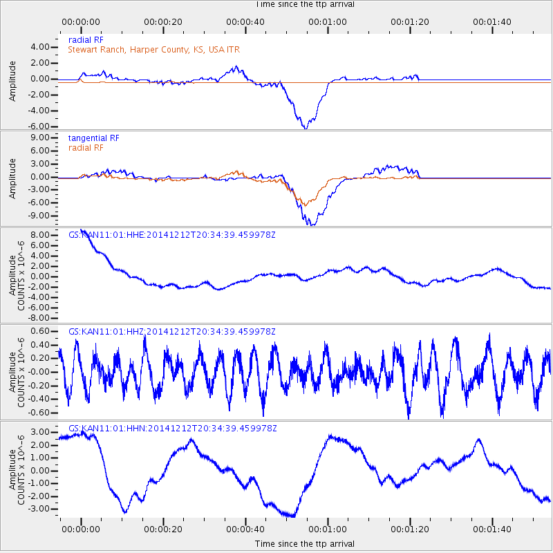
KAN11 Stewart Ranch, Harper County, KS, USA - Earthquake Result Viewer
*The percent match for this event was below the threshold and hence no stack was calculated.
| Earthquake location: |
Fiji Islands Region |
| Earthquake latitude/longitude: |
-18.9/-176.4 |
| Earthquake time(UTC): |
2014/12/12 (346) 20:22:35 GMT |
| Earthquake Depth: |
317 km |
| Earthquake Magnitude: |
5.8 MWW, 5.8 MWB |
| Earthquake Catalog/Contributor: |
NEIC PDE/NEIC COMCAT |
|
| Network: |
GS US Geological Survey Networks |
| Station: |
KAN11 Stewart Ranch, Harper County, KS, USA |
| Lat/Lon: |
37.21 N/97.91 W |
| Elevation: |
410 m |
|
| Distance: |
92.5 deg |
| Az: |
51.552 deg |
| Baz: |
248.239 deg |
| Ray Param: |
$rayparam |
*The percent match for this event was below the threshold and hence was not used in the summary stack. |
|
| Radial Match: |
31.036251 % |
| Radial Bump: |
400 |
| Transverse Match: |
44.56142 % |
| Transverse Bump: |
400 |
| SOD ConfigId: |
826047 |
| Insert Time: |
2014-12-26 20:42:22.016 +0000 |
| GWidth: |
2.5 |
| Max Bumps: |
400 |
| Tol: |
0.001 |
|
Signal To Noise
| Channel | StoN | STA | LTA |
| GS:KAN11:01:HHZ:20141212T20:34:39.459978Z | 0.74186176 | 2.4831573E-7 | 3.347197E-7 |
| GS:KAN11:01:HHN:20141212T20:34:39.459978Z | 1.6527582 | 3.9609927E-6 | 2.3965954E-6 |
| GS:KAN11:01:HHE:20141212T20:34:39.459978Z | 0.93407214 | 3.100774E-6 | 3.31963E-6 |
| Arrivals |
| Ps | |
| PpPs | |
| PsPs/PpSs | |


