You are here: Home > Network List > II - Global Seismograph Network (GSN - IRIS/IDA) Stations List
> Station WRAB Tennant Creek, NT, Australia > Earthquake Result Viewer
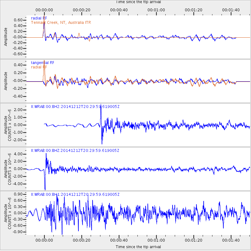
WRAB Tennant Creek, NT, Australia - Earthquake Result Viewer
*The percent match for this event was below the threshold and hence no stack was calculated.
| Earthquake location: |
Fiji Islands Region |
| Earthquake latitude/longitude: |
-18.9/-176.4 |
| Earthquake time(UTC): |
2014/12/12 (346) 20:22:35 GMT |
| Earthquake Depth: |
317 km |
| Earthquake Magnitude: |
5.8 MWW, 5.8 MWB |
| Earthquake Catalog/Contributor: |
NEIC PDE/NEIC COMCAT |
|
| Network: |
II Global Seismograph Network (GSN - IRIS/IDA) |
| Station: |
WRAB Tennant Creek, NT, Australia |
| Lat/Lon: |
19.93 S/134.36 E |
| Elevation: |
366 m |
|
| Distance: |
46.3 deg |
| Az: |
260.193 deg |
| Baz: |
97.399 deg |
| Ray Param: |
$rayparam |
*The percent match for this event was below the threshold and hence was not used in the summary stack. |
|
| Radial Match: |
72.286194 % |
| Radial Bump: |
400 |
| Transverse Match: |
60.203037 % |
| Transverse Bump: |
400 |
| SOD ConfigId: |
826047 |
| Insert Time: |
2014-12-26 20:43:52.514 +0000 |
| GWidth: |
2.5 |
| Max Bumps: |
400 |
| Tol: |
0.001 |
|
Signal To Noise
| Channel | StoN | STA | LTA |
| II:WRAB:00:BHZ:20141212T20:29:59.619005Z | 8.417318 | 1.8806129E-6 | 2.2342184E-7 |
| II:WRAB:00:BH1:20141212T20:29:59.619005Z | 2.094292 | 2.7794198E-7 | 1.3271406E-7 |
| II:WRAB:00:BH2:20141212T20:29:59.619005Z | 8.122807 | 9.624437E-7 | 1.1848659E-7 |
| Arrivals |
| Ps | |
| PpPs | |
| PsPs/PpSs | |


