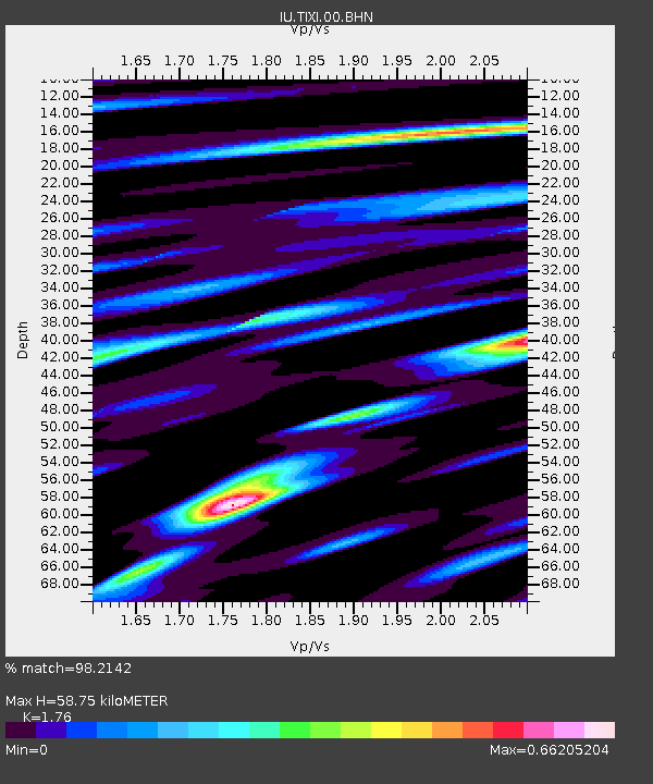
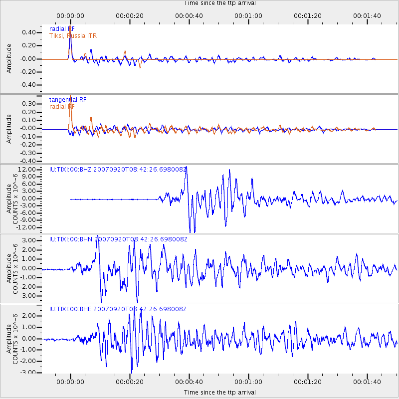
TIXI Tiksi, Russia - Earthquake Result Viewer

Earthquake location: Southern Sumatra, Indonesia
Earthquake latitude/longitude: -2.0/100.1
Earthquake time(UTC): 2007/09/20 (263) 08:31:14 GMT
Earthquake Depth: 30 km
Earthquake Magnitude: 6.3 MB, 6.8 MS, 6.7 MW, 6.3 ME
Earthquake Catalog/Contributor: WHDF/NEIC
Network: IU Global Seismograph Network (GSN - IRIS/USGS)
Station: TIXI Tiksi, Russia
Lat/Lon: 71.65 N/128.87 E
Elevation: 50 m
Distance: 75.8 deg
Az: 9.033 deg
Baz: 209.695 deg
Ray Param: 0.0513608
Estimated Moho Depth: 58.75 km
Estimated Crust Vp/Vs: 1.76
Assumed Crust Vp: 6.552 km/s
Estimated Crust Vs: 3.723 km/s
Estimated Crust Poisson's Ratio: 0.26
Radial Match: 98.2142 %
Radial Bump: 395
Transverse Match: 96.67983 %
Transverse Bump: 400
SOD ConfigId: 2564
Insert Time: 2010-03-02 14:50:24.380 +0000
GWidth: 2.5
Max Bumps: 400
Tol: 0.001

Signal To Noise

ChannelStoNSTALTA
IU:TIXI:00:BHN:20070920T08:42:26.698008Z8.3175293.378224E-74.0615717E-8
IU:TIXI:00:BHE:20070920T08:42:26.698008Z3.6390121.4471341E-73.9767222E-8
IU:TIXI:00:BHZ:20070920T08:42:26.698008Z21.3984641.2260308E-65.729527E-8
Arrivals
Ps7.0 SECOND
PpPs24 SECOND
PsPs/PpSs31 SECOND