You are here: Home > Network List > GT - Global Telemetered Seismograph Network (USAF/USGS) Stations List
> Station LPAZ La Paz , Bolivia > Earthquake Result Viewer
LPAZ La Paz , Bolivia - Earthquake Result Viewer

| Earthquake location: |
South Sandwich Islands Region |
| Earthquake latitude/longitude: |
-56.6/-25.4 |
| Earthquake time(UTC): |
2014/12/18 (352) 20:10:53 GMT |
| Earthquake Depth: |
9.3 km |
| Earthquake Magnitude: |
5.6 MB |
| Earthquake Catalog/Contributor: |
NEIC PDE/NEIC COMCAT |
|
| Network: |
GT Global Telemetered Seismograph Network (USAF/USGS) |
| Station: |
LPAZ La Paz , Bolivia |
| Lat/Lon: |
16.17 S/68.08 W |
| Elevation: |
4817 m |
|
| Distance: |
51.6 deg |
| Az: |
303.786 deg |
| Baz: |
151.43 deg |
| Ray Param: |
0.067320265 |
| Estimated Moho Depth: |
27.25 km |
| Estimated Crust Vp/Vs: |
1.60 |
| Assumed Crust Vp: |
6.454 km/s |
| Estimated Crust Vs: |
4.034 km/s |
| Estimated Crust Poisson's Ratio: |
0.18 |
|
| Radial Match: |
85.50303 % |
| Radial Bump: |
400 |
| Transverse Match: |
85.02535 % |
| Transverse Bump: |
400 |
| SOD ConfigId: |
826381 |
| Insert Time: |
2015-01-01 20:21:33.792 +0000 |
| GWidth: |
2.5 |
| Max Bumps: |
400 |
| Tol: |
0.001 |
|
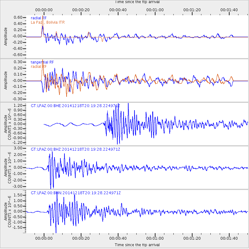
Signal To Noise
| Channel | StoN | STA | LTA |
| GT:LPAZ:00:BHZ:20141218T20:19:28.224971Z | 13.660139 | 1.1855834E-6 | 8.679146E-8 |
| GT:LPAZ:00:BHN:20141218T20:19:28.224971Z | 6.525975 | 3.5162017E-7 | 5.3880093E-8 |
| GT:LPAZ:00:BHE:20141218T20:19:28.224971Z | 4.809811 | 2.9466574E-7 | 6.126348E-8 |
| Arrivals |
| Ps | 2.7 SECOND |
| PpPs | 10 SECOND |
| PsPs/PpSs | 13 SECOND |


