You are here: Home > Network List > CI - Caltech Regional Seismic Network Stations List
> Station MPM Manuel Prospect Mine, California, USA > Earthquake Result Viewer
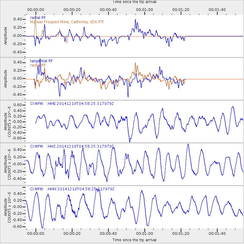
MPM Manuel Prospect Mine, California, USA - Earthquake Result Viewer
*The percent match for this event was below the threshold and hence no stack was calculated.
| Earthquake location: |
Hokkaido, Japan Region |
| Earthquake latitude/longitude: |
42.7/145.5 |
| Earthquake time(UTC): |
2014/12/19 (353) 04:47:40 GMT |
| Earthquake Depth: |
32 km |
| Earthquake Magnitude: |
5.5 MB |
| Earthquake Catalog/Contributor: |
NEIC PDE/NEIC COMCAT |
|
| Network: |
CI Caltech Regional Seismic Network |
| Station: |
MPM Manuel Prospect Mine, California, USA |
| Lat/Lon: |
36.06 N/117.49 W |
| Elevation: |
185 m |
|
| Distance: |
71.1 deg |
| Az: |
58.2 deg |
| Baz: |
309.395 deg |
| Ray Param: |
$rayparam |
*The percent match for this event was below the threshold and hence was not used in the summary stack. |
|
| Radial Match: |
49.40859 % |
| Radial Bump: |
400 |
| Transverse Match: |
62.7458 % |
| Transverse Bump: |
400 |
| SOD ConfigId: |
826415 |
| Insert Time: |
2015-01-02 05:04:39.006 +0000 |
| GWidth: |
2.5 |
| Max Bumps: |
400 |
| Tol: |
0.001 |
|
Signal To Noise
| Channel | StoN | STA | LTA |
| CI:MPM: :HHZ:20141219T04:58:25.317979Z | 0.9981735 | 2.2502137E-7 | 2.2543313E-7 |
| CI:MPM: :HHN:20141219T04:58:25.317979Z | 2.7845685 | 4.0397262E-7 | 1.4507548E-7 |
| CI:MPM: :HHE:20141219T04:58:25.317979Z | 1.2725987 | 1.8675962E-7 | 1.4675453E-7 |
| Arrivals |
| Ps | |
| PpPs | |
| PsPs/PpSs | |


