You are here: Home > Network List > GS - US Geological Survey Networks Stations List
> Station KAN11 Stewart Ranch, Harper County, KS, USA > Earthquake Result Viewer
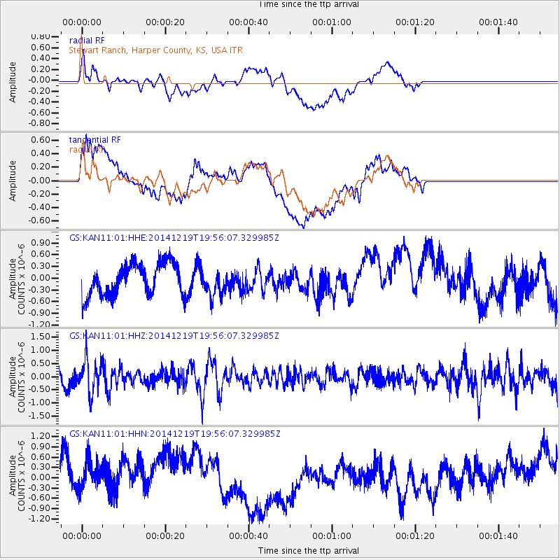
KAN11 Stewart Ranch, Harper County, KS, USA - Earthquake Result Viewer
*The percent match for this event was below the threshold and hence no stack was calculated.
| Earthquake location: |
Leeward Islands |
| Earthquake latitude/longitude: |
16.2/-61.8 |
| Earthquake time(UTC): |
2014/12/19 (353) 19:49:29 GMT |
| Earthquake Depth: |
114 km |
| Earthquake Magnitude: |
5.6 MWW, 5.6 MWB |
| Earthquake Catalog/Contributor: |
NEIC PDE/NEIC COMCAT |
|
| Network: |
GS US Geological Survey Networks |
| Station: |
KAN11 Stewart Ranch, Harper County, KS, USA |
| Lat/Lon: |
37.21 N/97.91 W |
| Elevation: |
410 m |
|
| Distance: |
38.1 deg |
| Az: |
310.347 deg |
| Baz: |
113.485 deg |
| Ray Param: |
$rayparam |
*The percent match for this event was below the threshold and hence was not used in the summary stack. |
|
| Radial Match: |
43.23078 % |
| Radial Bump: |
400 |
| Transverse Match: |
44.65084 % |
| Transverse Bump: |
400 |
| SOD ConfigId: |
826536 |
| Insert Time: |
2015-01-02 20:09:01.355 +0000 |
| GWidth: |
2.5 |
| Max Bumps: |
400 |
| Tol: |
0.001 |
|
Signal To Noise
| Channel | StoN | STA | LTA |
| GS:KAN11:01:HHZ:20141219T19:56:07.329985Z | 1.7805502 | 6.4656507E-7 | 3.6312656E-7 |
| GS:KAN11:01:HHN:20141219T19:56:07.329985Z | 0.84565794 | 6.550573E-7 | 7.7461266E-7 |
| GS:KAN11:01:HHE:20141219T19:56:07.329985Z | 0.82410514 | 3.4029478E-7 | 4.129264E-7 |
| Arrivals |
| Ps | |
| PpPs | |
| PsPs/PpSs | |


