You are here: Home > Network List > TA - USArray Transportable Network (new EarthScope stations) Stations List
> Station G59A Clarenceville, QC, USA > Earthquake Result Viewer
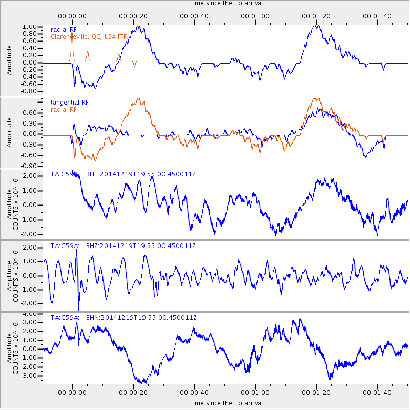
G59A Clarenceville, QC, USA - Earthquake Result Viewer
*The percent match for this event was below the threshold and hence no stack was calculated.
| Earthquake location: |
Leeward Islands |
| Earthquake latitude/longitude: |
16.2/-61.8 |
| Earthquake time(UTC): |
2014/12/19 (353) 19:49:29 GMT |
| Earthquake Depth: |
114 km |
| Earthquake Magnitude: |
5.6 MWW, 5.6 MWB |
| Earthquake Catalog/Contributor: |
NEIC PDE/NEIC COMCAT |
|
| Network: |
TA USArray Transportable Network (new EarthScope stations) |
| Station: |
G59A Clarenceville, QC, USA |
| Lat/Lon: |
45.08 N/73.18 W |
| Elevation: |
36 m |
|
| Distance: |
30.4 deg |
| Az: |
343.936 deg |
| Baz: |
157.959 deg |
| Ray Param: |
$rayparam |
*The percent match for this event was below the threshold and hence was not used in the summary stack. |
|
| Radial Match: |
25.017029 % |
| Radial Bump: |
400 |
| Transverse Match: |
38.61467 % |
| Transverse Bump: |
400 |
| SOD ConfigId: |
826536 |
| Insert Time: |
2015-01-02 20:20:39.353 +0000 |
| GWidth: |
2.5 |
| Max Bumps: |
400 |
| Tol: |
0.001 |
|
Signal To Noise
| Channel | StoN | STA | LTA |
| TA:G59A: :BHZ:20141219T19:55:00.450011Z | 1.740117 | 9.943377E-7 | 5.7142006E-7 |
| TA:G59A: :BHN:20141219T19:55:00.450011Z | 3.3575628 | 3.0594329E-6 | 9.112065E-7 |
| TA:G59A: :BHE:20141219T19:55:00.450011Z | 0.6104621 | 4.822983E-7 | 7.900544E-7 |
| Arrivals |
| Ps | |
| PpPs | |
| PsPs/PpSs | |


