You are here: Home > Network List > US - United States National Seismic Network Stations List
> Station DUG Dugway, Tooele County, Utah, USA > Earthquake Result Viewer
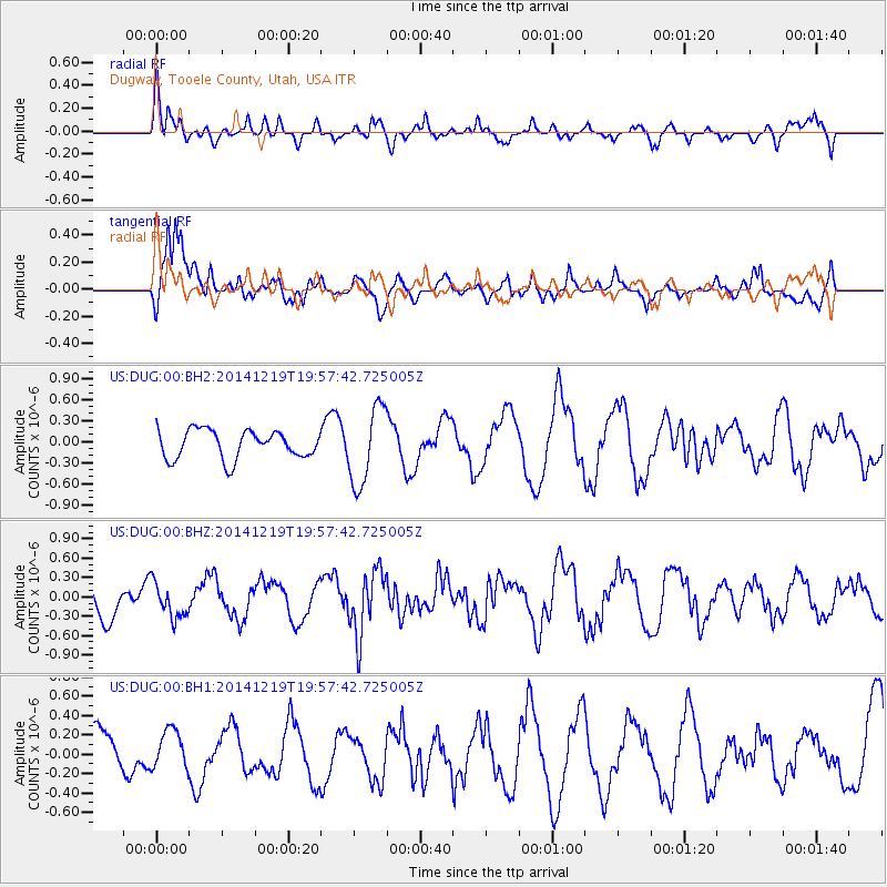
DUG Dugway, Tooele County, Utah, USA - Earthquake Result Viewer
*The percent match for this event was below the threshold and hence no stack was calculated.
| Earthquake location: |
Leeward Islands |
| Earthquake latitude/longitude: |
16.2/-61.8 |
| Earthquake time(UTC): |
2014/12/19 (353) 19:49:29 GMT |
| Earthquake Depth: |
114 km |
| Earthquake Magnitude: |
5.6 MWW, 5.6 MWB |
| Earthquake Catalog/Contributor: |
NEIC PDE/NEIC COMCAT |
|
| Network: |
US United States National Seismic Network |
| Station: |
DUG Dugway, Tooele County, Utah, USA |
| Lat/Lon: |
40.19 N/112.81 W |
| Elevation: |
1477 m |
|
| Distance: |
50.1 deg |
| Az: |
309.114 deg |
| Baz: |
103.281 deg |
| Ray Param: |
$rayparam |
*The percent match for this event was below the threshold and hence was not used in the summary stack. |
|
| Radial Match: |
45.6759 % |
| Radial Bump: |
400 |
| Transverse Match: |
79.35497 % |
| Transverse Bump: |
400 |
| SOD ConfigId: |
826536 |
| Insert Time: |
2015-01-02 20:22:36.852 +0000 |
| GWidth: |
2.5 |
| Max Bumps: |
400 |
| Tol: |
0.001 |
|
Signal To Noise
| Channel | StoN | STA | LTA |
| US:DUG:00:BHZ:20141219T19:57:42.725005Z | 0.6147532 | 2.7134266E-7 | 4.413847E-7 |
| US:DUG:00:BH1:20141219T19:57:42.725005Z | 0.63293904 | 1.973741E-7 | 3.1183748E-7 |
| US:DUG:00:BH2:20141219T19:57:42.725005Z | 2.7704928 | 5.572442E-7 | 2.011354E-7 |
| Arrivals |
| Ps | |
| PpPs | |
| PsPs/PpSs | |


