You are here: Home > Network List > CI - Caltech Regional Seismic Network Stations List
> Station LRL Laurel Mtn Radio Fac, Ridgecrest, CA, USA > Earthquake Result Viewer
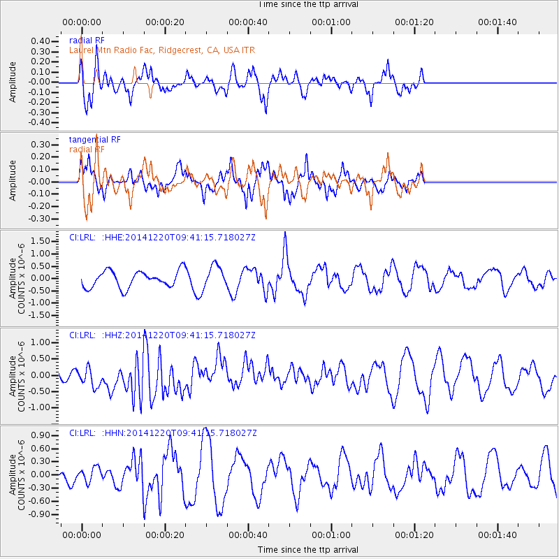
LRL Laurel Mtn Radio Fac, Ridgecrest, CA, USA - Earthquake Result Viewer
*The percent match for this event was below the threshold and hence no stack was calculated.
| Earthquake location: |
Near East Coast Of Honshu, Japan |
| Earthquake latitude/longitude: |
37.4/141.5 |
| Earthquake time(UTC): |
2014/12/20 (354) 09:29:58 GMT |
| Earthquake Depth: |
37 km |
| Earthquake Magnitude: |
5.9 MB |
| Earthquake Catalog/Contributor: |
NEIC PDE/NEIC COMCAT |
|
| Network: |
CI Caltech Regional Seismic Network |
| Station: |
LRL Laurel Mtn Radio Fac, Ridgecrest, CA, USA |
| Lat/Lon: |
35.48 N/117.68 W |
| Elevation: |
1340 m |
|
| Distance: |
76.8 deg |
| Az: |
55.433 deg |
| Baz: |
306.53 deg |
| Ray Param: |
$rayparam |
*The percent match for this event was below the threshold and hence was not used in the summary stack. |
|
| Radial Match: |
51.48959 % |
| Radial Bump: |
368 |
| Transverse Match: |
46.70422 % |
| Transverse Bump: |
317 |
| SOD ConfigId: |
826720 |
| Insert Time: |
2015-01-04 02:03:51.223 +0000 |
| GWidth: |
2.5 |
| Max Bumps: |
400 |
| Tol: |
0.001 |
|
Signal To Noise
| Channel | StoN | STA | LTA |
| CI:LRL: :HHZ:20141220T09:41:15.718027Z | 1.2230282 | 3.0973334E-7 | 2.532512E-7 |
| CI:LRL: :HHN:20141220T09:41:15.718027Z | 0.6379687 | 1.6425538E-7 | 2.574662E-7 |
| CI:LRL: :HHE:20141220T09:41:15.718027Z | 1.3853327 | 4.612766E-7 | 3.3297172E-7 |
| Arrivals |
| Ps | |
| PpPs | |
| PsPs/PpSs | |


