You are here: Home > Network List > US - United States National Seismic Network Stations List
> Station DGMT Dagmar, Montana, USA > Earthquake Result Viewer
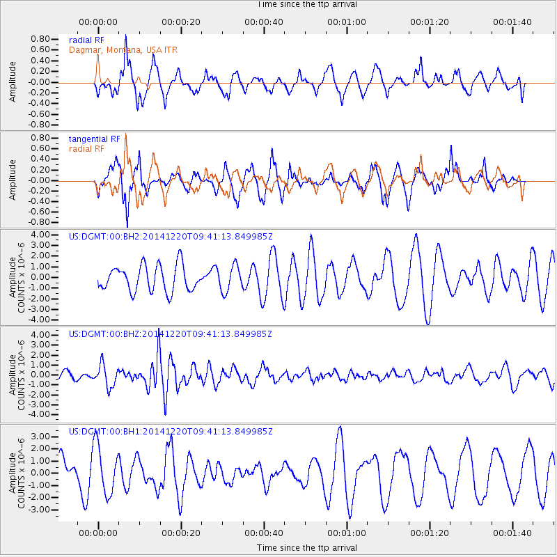
DGMT Dagmar, Montana, USA - Earthquake Result Viewer
*The percent match for this event was below the threshold and hence no stack was calculated.
| Earthquake location: |
Near East Coast Of Honshu, Japan |
| Earthquake latitude/longitude: |
37.4/141.5 |
| Earthquake time(UTC): |
2014/12/20 (354) 09:29:58 GMT |
| Earthquake Depth: |
37 km |
| Earthquake Magnitude: |
5.9 MB |
| Earthquake Catalog/Contributor: |
NEIC PDE/NEIC COMCAT |
|
| Network: |
US United States National Seismic Network |
| Station: |
DGMT Dagmar, Montana, USA |
| Lat/Lon: |
48.47 N/104.20 W |
| Elevation: |
0.0 m |
|
| Distance: |
76.5 deg |
| Az: |
38.61 deg |
| Baz: |
311.689 deg |
| Ray Param: |
$rayparam |
*The percent match for this event was below the threshold and hence was not used in the summary stack. |
|
| Radial Match: |
55.852196 % |
| Radial Bump: |
389 |
| Transverse Match: |
60.041595 % |
| Transverse Bump: |
326 |
| SOD ConfigId: |
826720 |
| Insert Time: |
2015-01-04 02:48:49.137 +0000 |
| GWidth: |
2.5 |
| Max Bumps: |
400 |
| Tol: |
0.001 |
|
Signal To Noise
| Channel | StoN | STA | LTA |
| US:DGMT:00:BHZ:20141220T09:41:13.849985Z | 2.1794972 | 1.1384865E-6 | 5.22362E-7 |
| US:DGMT:00:BH1:20141220T09:41:13.849985Z | 1.5260563 | 1.9913741E-6 | 1.3049154E-6 |
| US:DGMT:00:BH2:20141220T09:41:13.849985Z | 1.0061948 | 1.2111882E-6 | 1.2037312E-6 |
| Arrivals |
| Ps | |
| PpPs | |
| PsPs/PpSs | |


